

Geo Connect Asia 2025
Opening Ceremony Launch
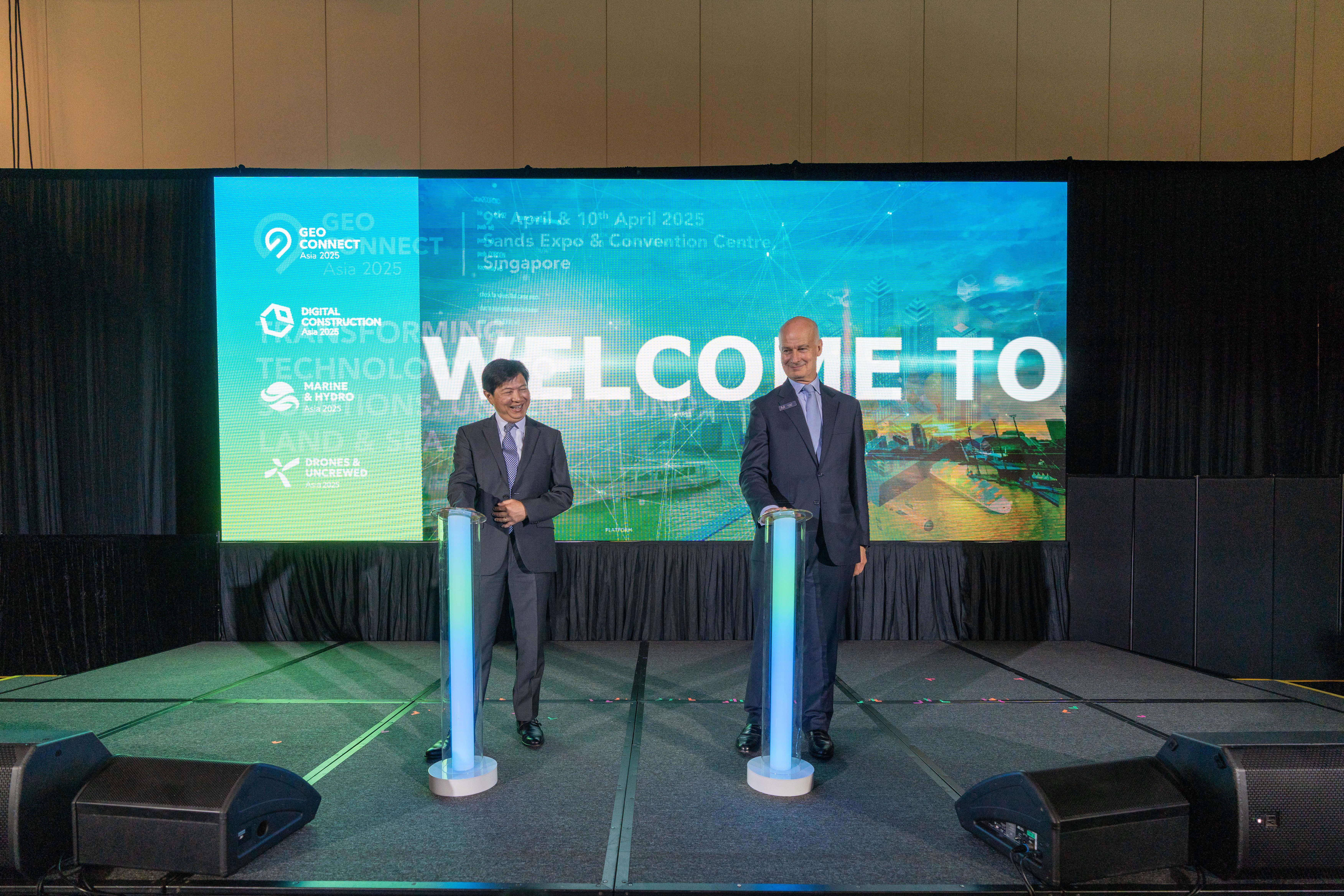
The fifth edition of Geo Connect Asia 2025 commenced with an opening ceremony led by Mr Yeoh Oon Jin, Chairman of Singapore Land Authority (SLA) and Mr Rupert Owen, Co-Founder of Geo Connect Asia. Following welcome remarks by Mr Rupert Owen, Mr Yeoh announced the official expansion of two key initiatives: the Living Asset MaP (LAMP) and Barrier-Free-Access (BFA).
Living Asset MaP (LAMP) expanding to more precints across Singapore

Living Asset MaP (LAMP) is a community-centric initiative co-developed by SLA and SingHealth Community Hospitals, and supported by the MOH Office for Healthcare Transformation to enable social prescribing. From its pilot in Sengkang, LAMP is now expanding to more precincts across Singapore, connecting more seniors to local activities and services which will enable them to stay active and engaged, improving their overall health and wellbeing.
Expansion of Barrier-Free-Access Mapping from Outdoor to Indoor
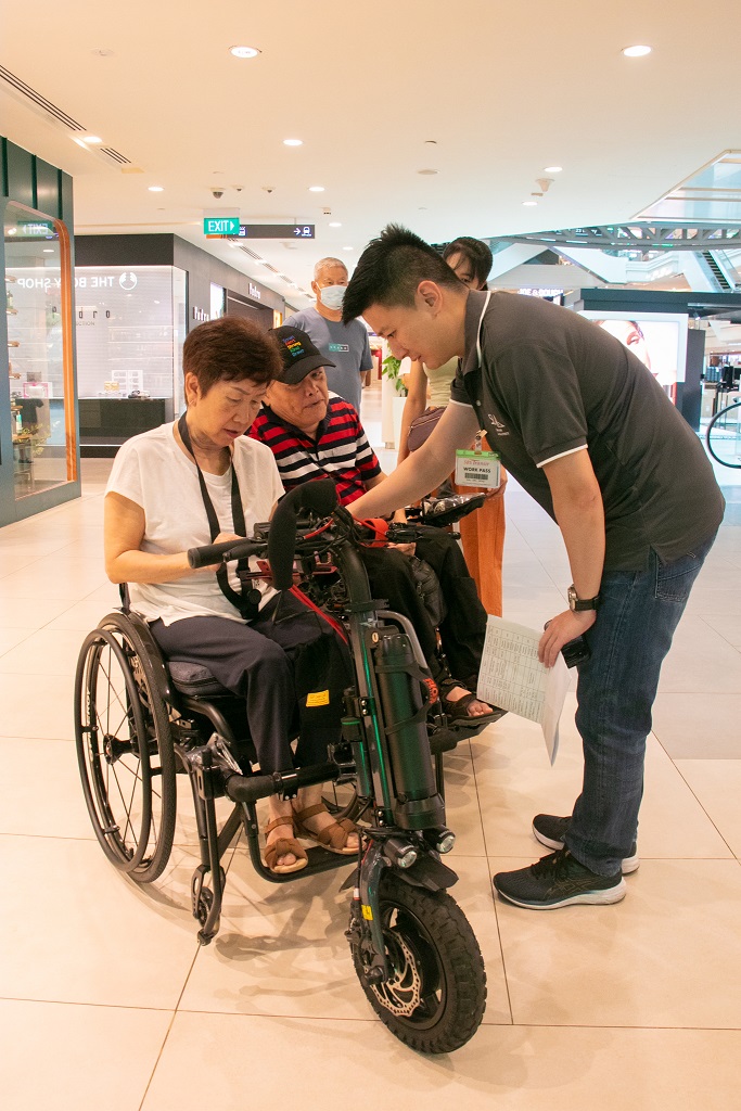
Barrier-Free-Access (BFA) initiative was started with an aim to help wheelchair users move around Singapore more easily. What began with 1,000 km of accessible paths in nine areas including Bukit Merah, Ang Mo Kio and Orchard now has an additional 5,000 km of barrier-free routes being mapped across Singapore. Clementi, West Coast and the National University of Singapore campus were among the latest areas added to OneMap BFA. This initiative is further strengthened through a tripartite MOU signed in November 2024 between SLA, the Real Estate Developers’ Association of Singapore (REDAS) and SG Enable, which aims to extend BFA mapping from outdoor routes to indoor spaces including shopping malls, creating a seamless navigation experience.
Singapore Joins Global Efforts to Boost Land Motion and Climate Monitoring Efforts
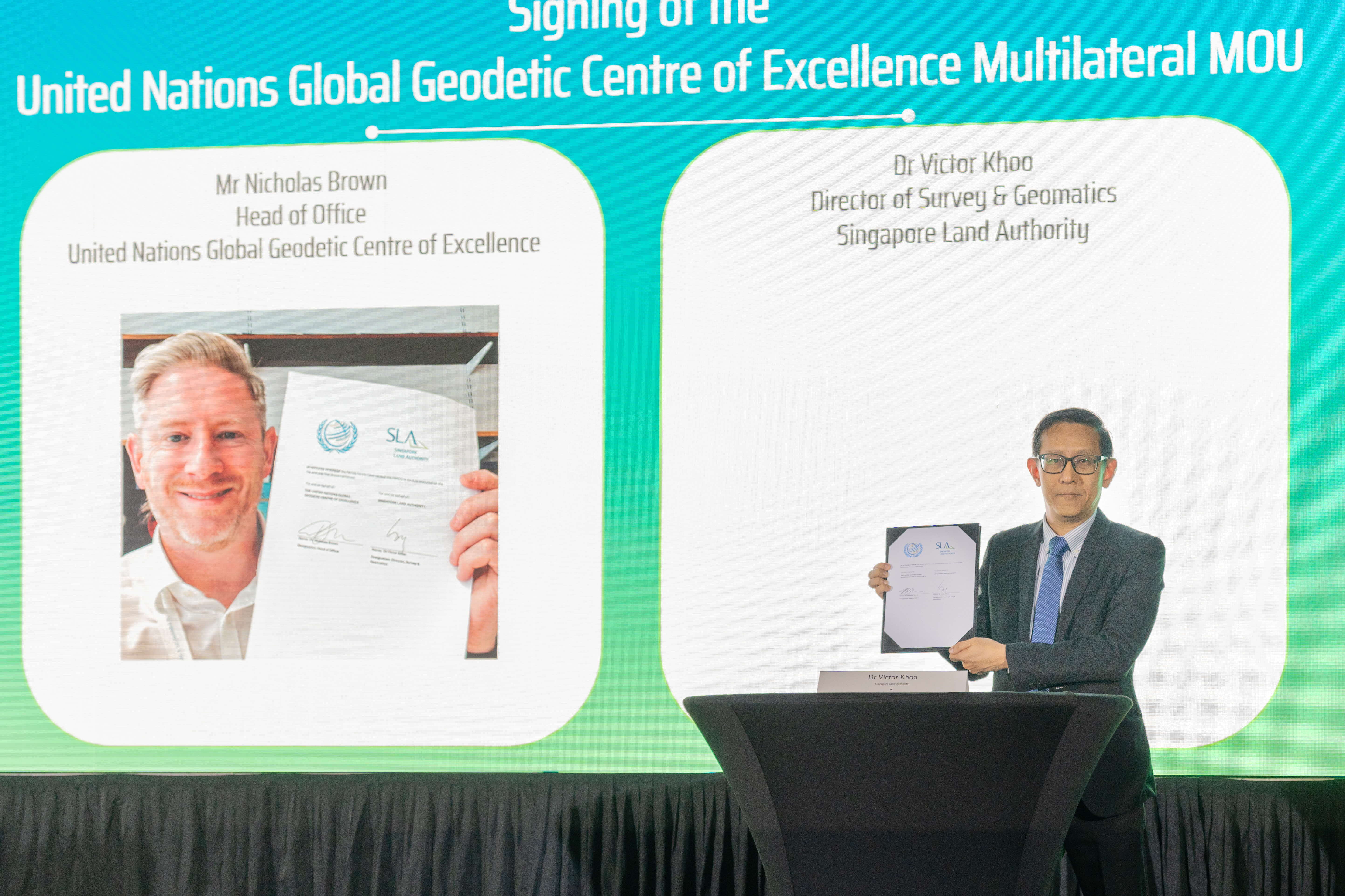
SLA officially signed a Multilateral Memorandum of Understanding (MMOU) with the United Nations Global Geodetic Centre of Excellence (UN-GGCE) and close to 40 participating member states and organisations—uniting efforts to strengthen global geodetic infrastructure that underpins critical positioning, navigation and timing services worldwide.
This collaboration supports Singapore’s vision of being a safe, sustainable, and smart nation—enabling smarter climate monitoring, coastal protection strategies, and future-ready infrastructure development.
While rising sea levels have dominated climate discourse, land motion—especially subsidence—remains an often-overlooked factor. Without long-term land motion data, we risk underestimating the real extent of climate vulnerabilities, particularly for a low-lying, highly urbanised island state like Singapore.
In response, SLA is embarking on the first nationwide compilation of long-term land motion data. This foundational geospatial initiative will support key agencies like Maritime and Port Authority of Singapore (MPA), PUB, Singapore's National Water Agency, and Centre for Climate Research Singapore in predictive and preventive climate resilience planning. It will also inform the monitoring of infrastructure stability, settlement of reclaimed land, and impacts from underground construction.
The MMOU reflects Singapore’s bold commitment to international cooperation, and ensures that we have the tools, data and partnerships needed to build long-term urban and climate resilience.
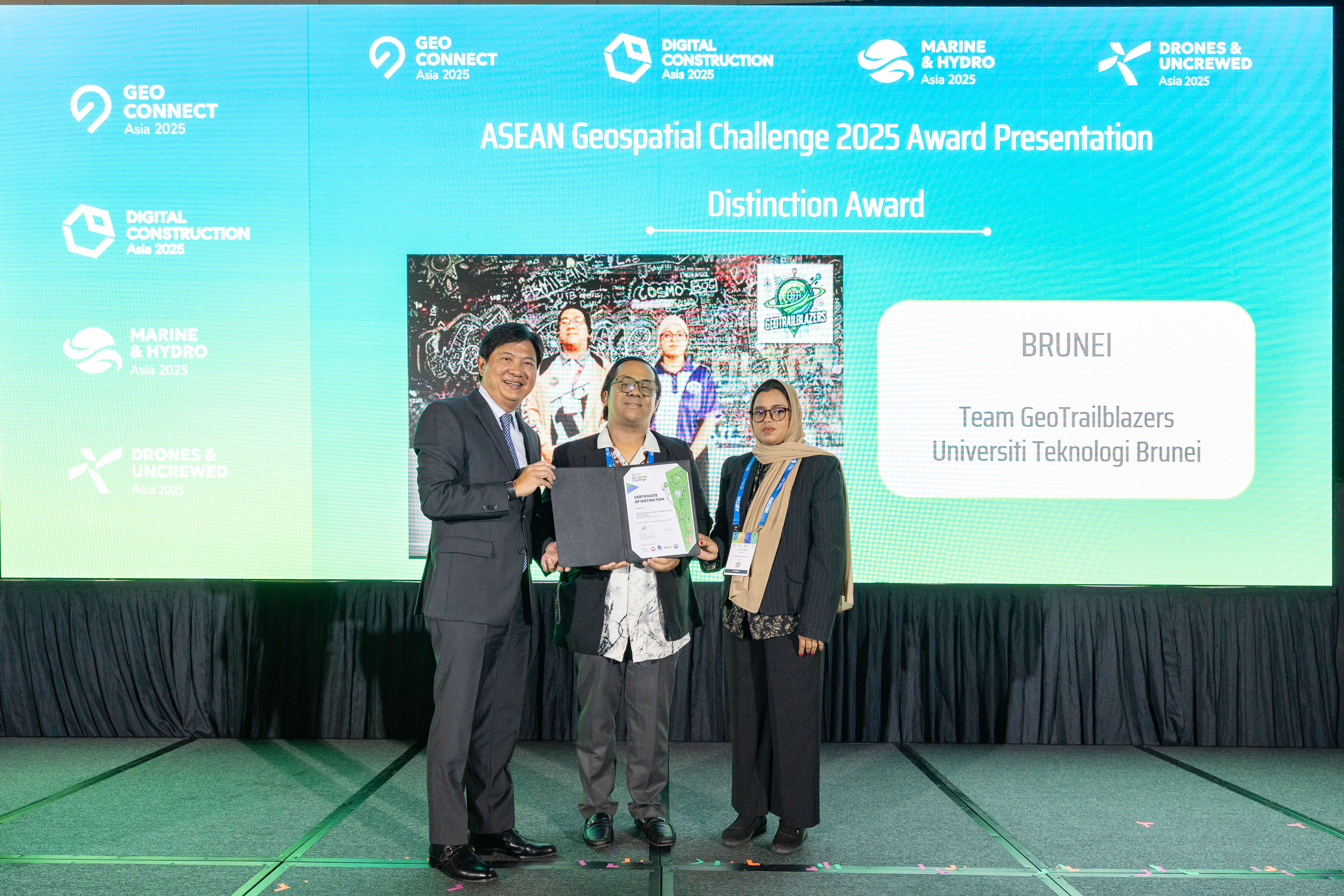
ASEAN Geospatial Challenge 2025 and Map Our World 2024
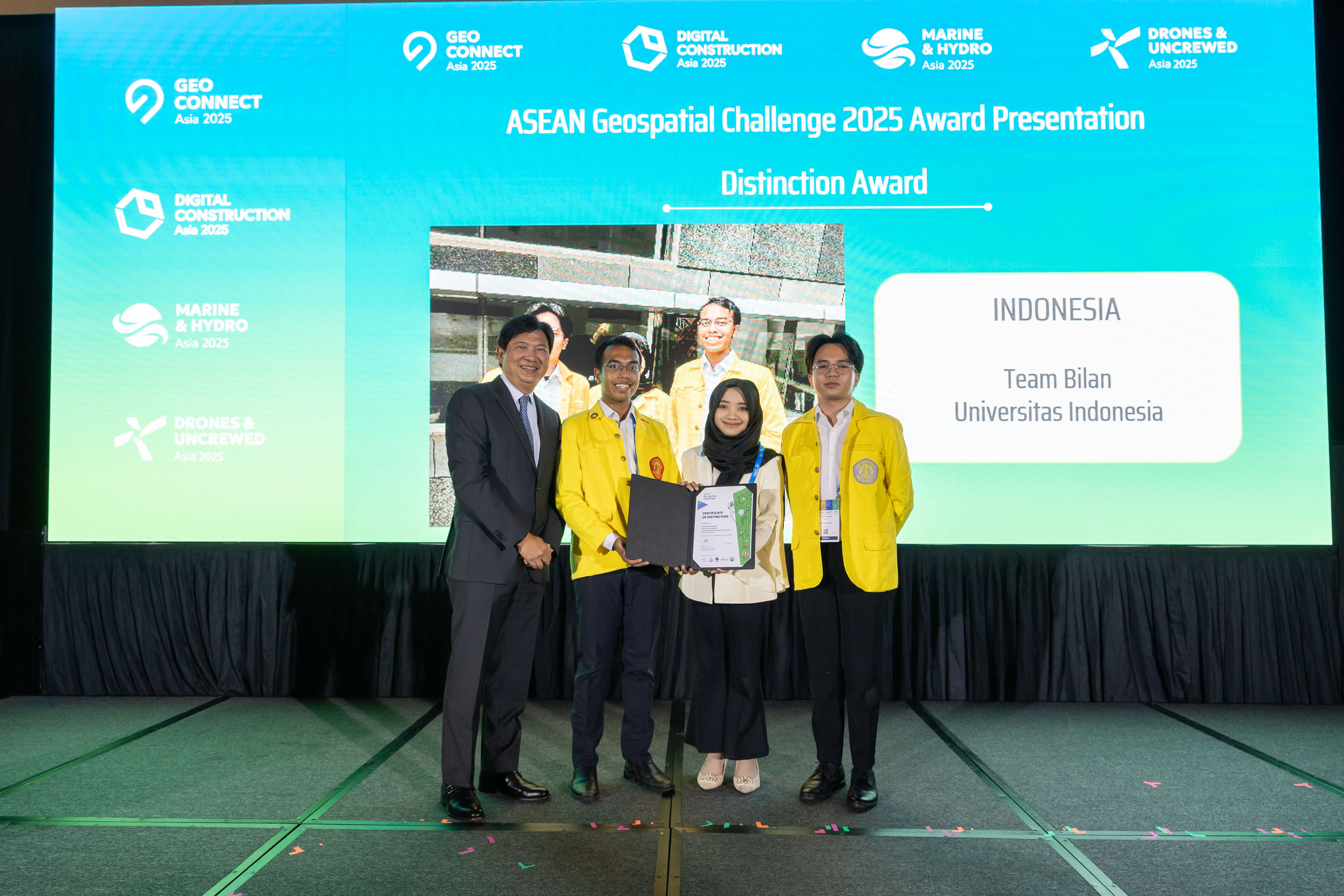
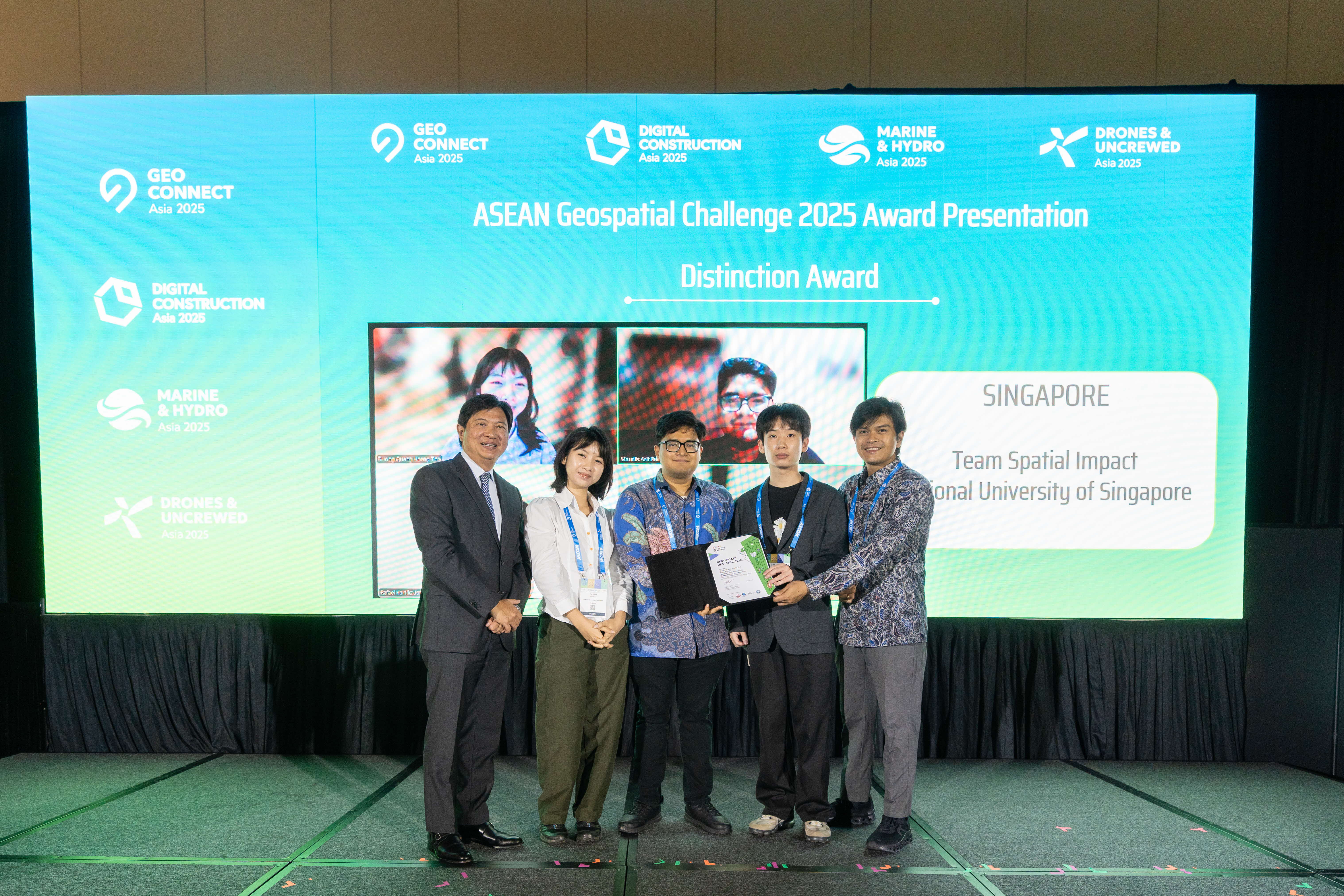
The ASEAN Geospatial Challenge 2025 brings youth in the ASEAN region together to use geospatial technology and information to support nations’ efforts to achieve the United Nation’s Sustainable Development Goals.
Organised by SLA and supported by geospatial agencies from Brunei Darussalam, Indonesia, Philippines and Thailand, this year’s challenge attracted 35 entries from IHLs in the region. Out of these entries, 3 teams in the Distinction Category received their awards from Mr Yeoh during the event.
Find out more here.
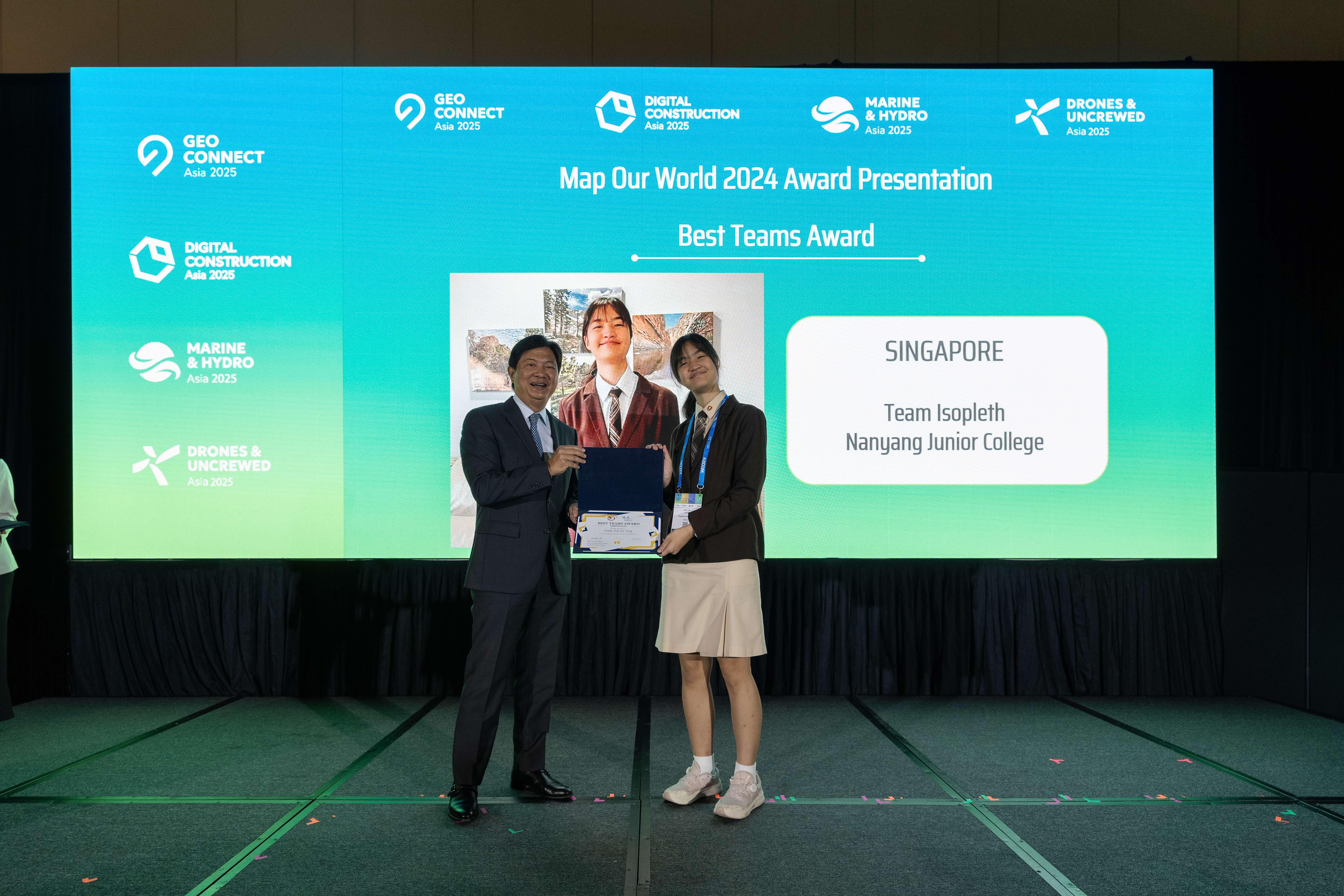
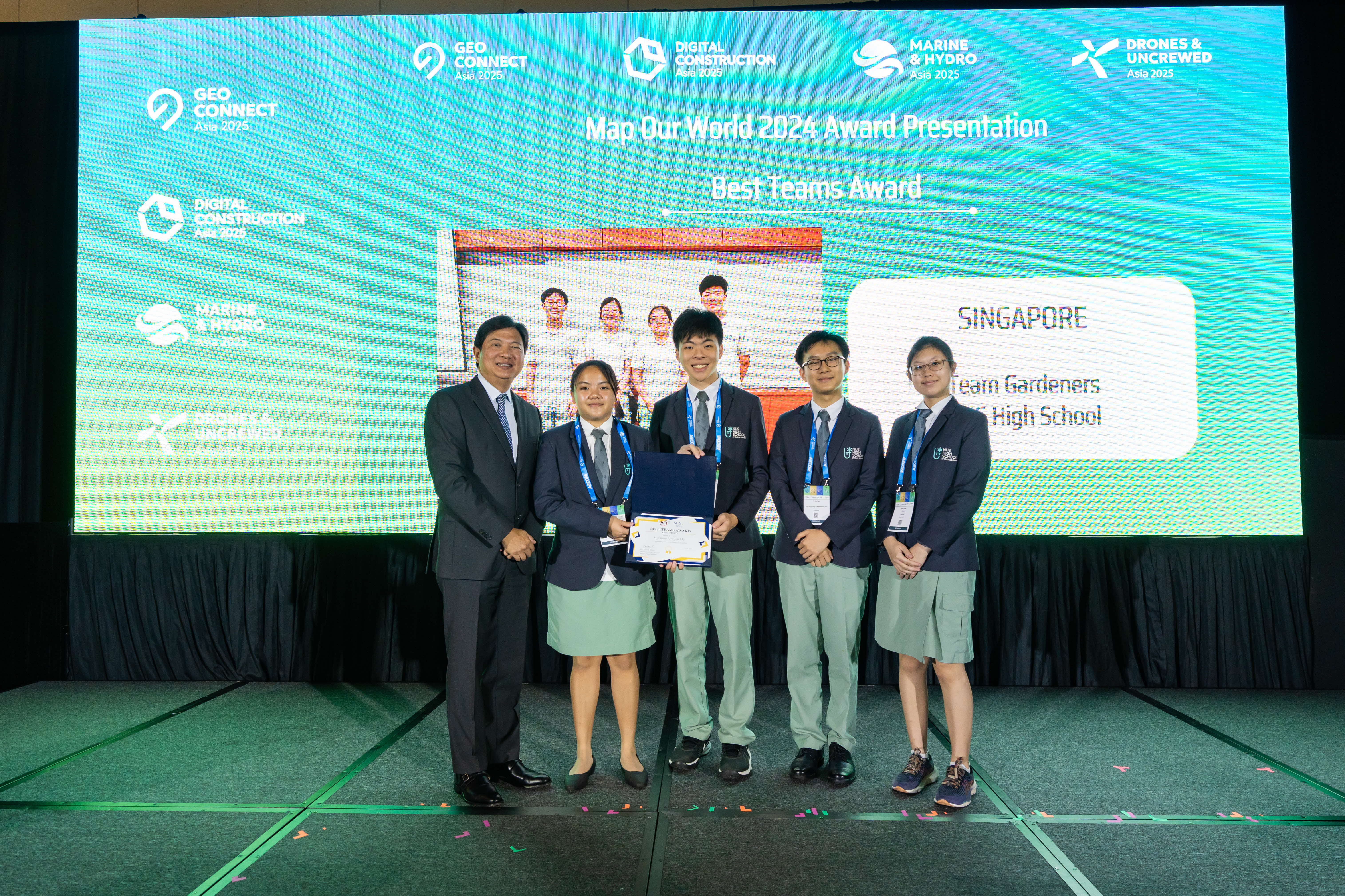
Map Our World 2024 – a Public-Private-Partnership (PPP) approach towards increasing awareness for a career in Geomatics for students.
Map Our World (MoW) is a geospatial awareness building initiative for students. MoW 2024 is organised by SLA and supported by MOE, Bentley, ESRI, Leica Geosystems, Maxar, SISV and Trimble.
The two best teams received their awards from Mr Yeoh on stage.
Exhibition Tour led by SLA Chairman, H.E. Dr. Eng. Mohammed Al Sayel, and Delegates
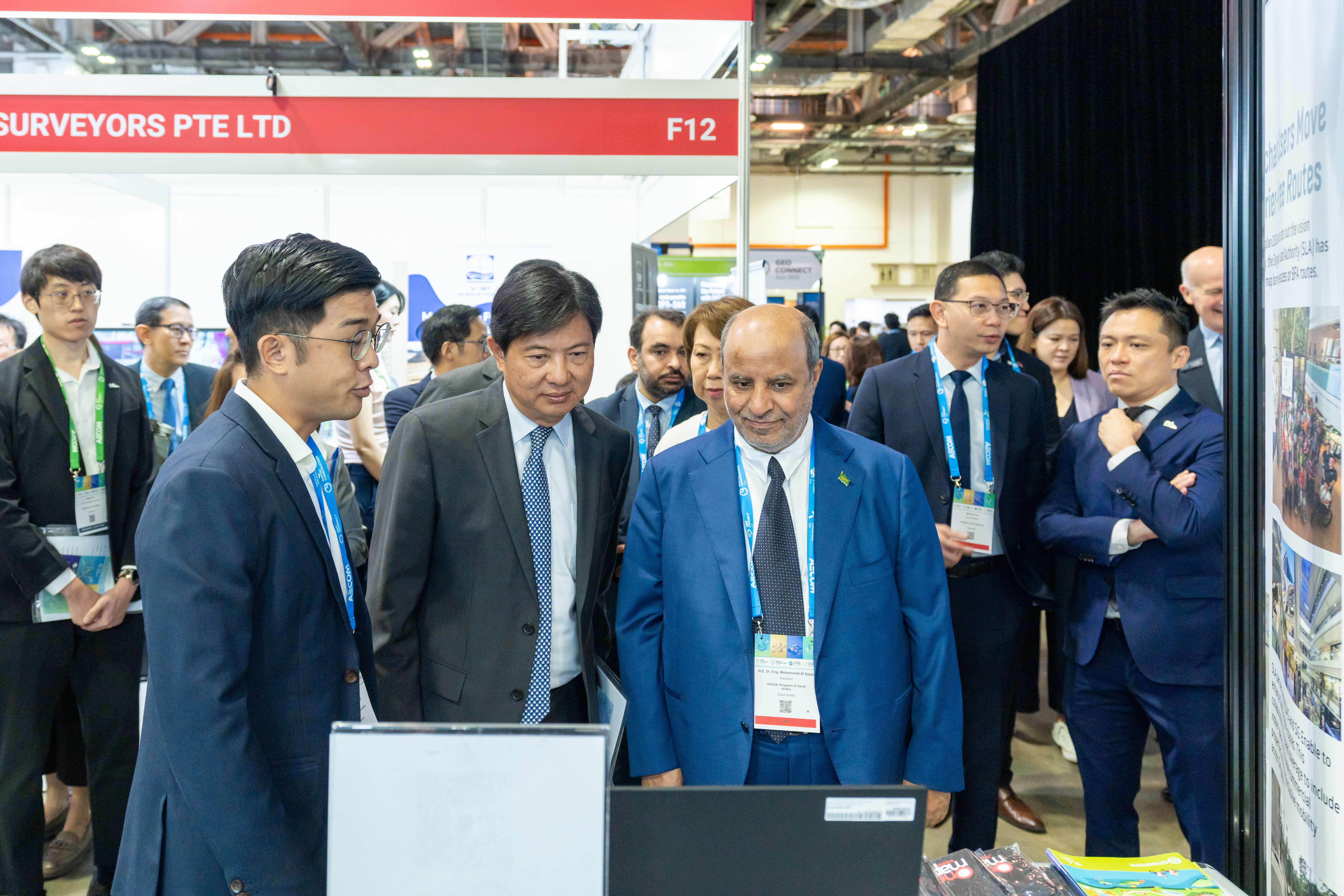
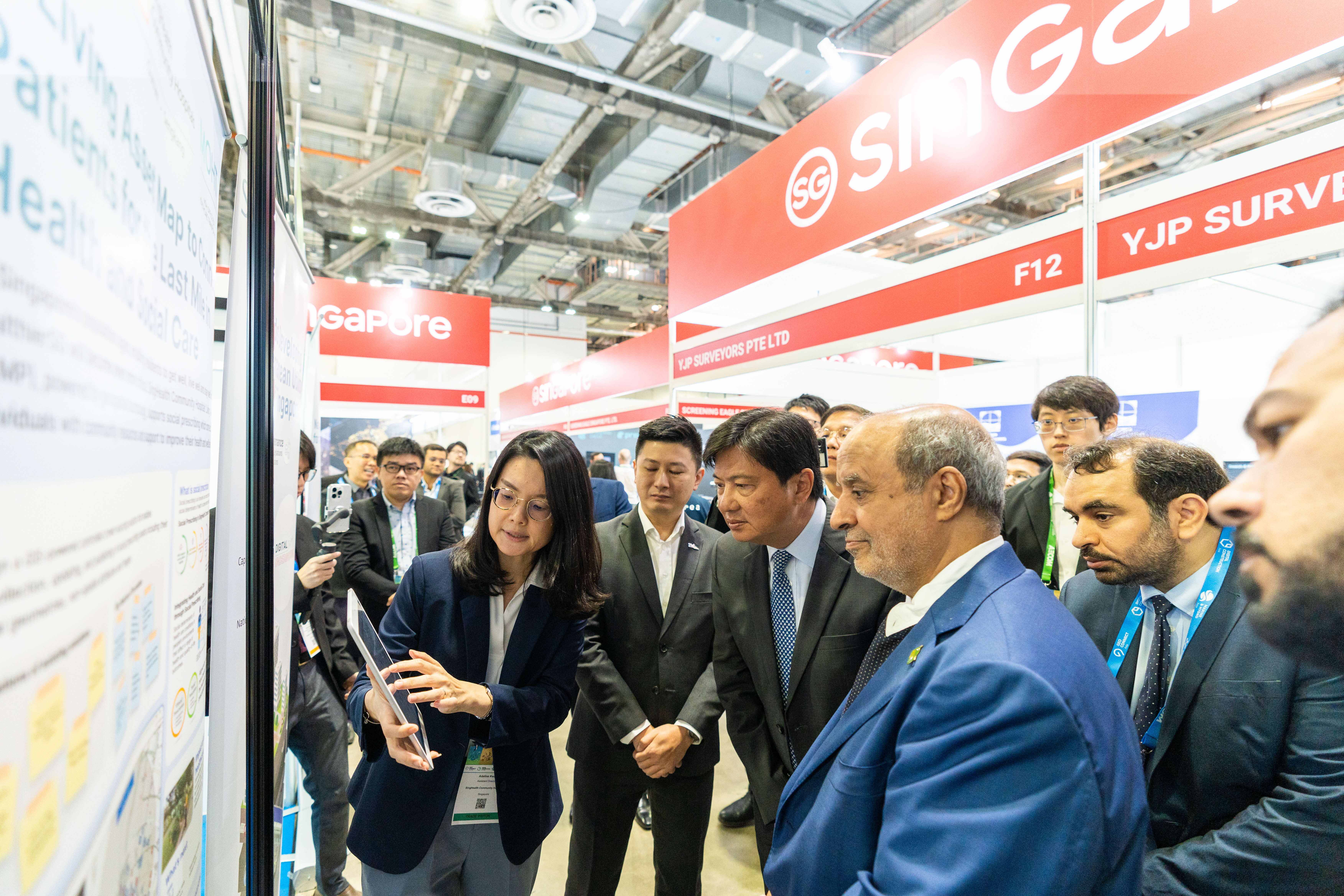
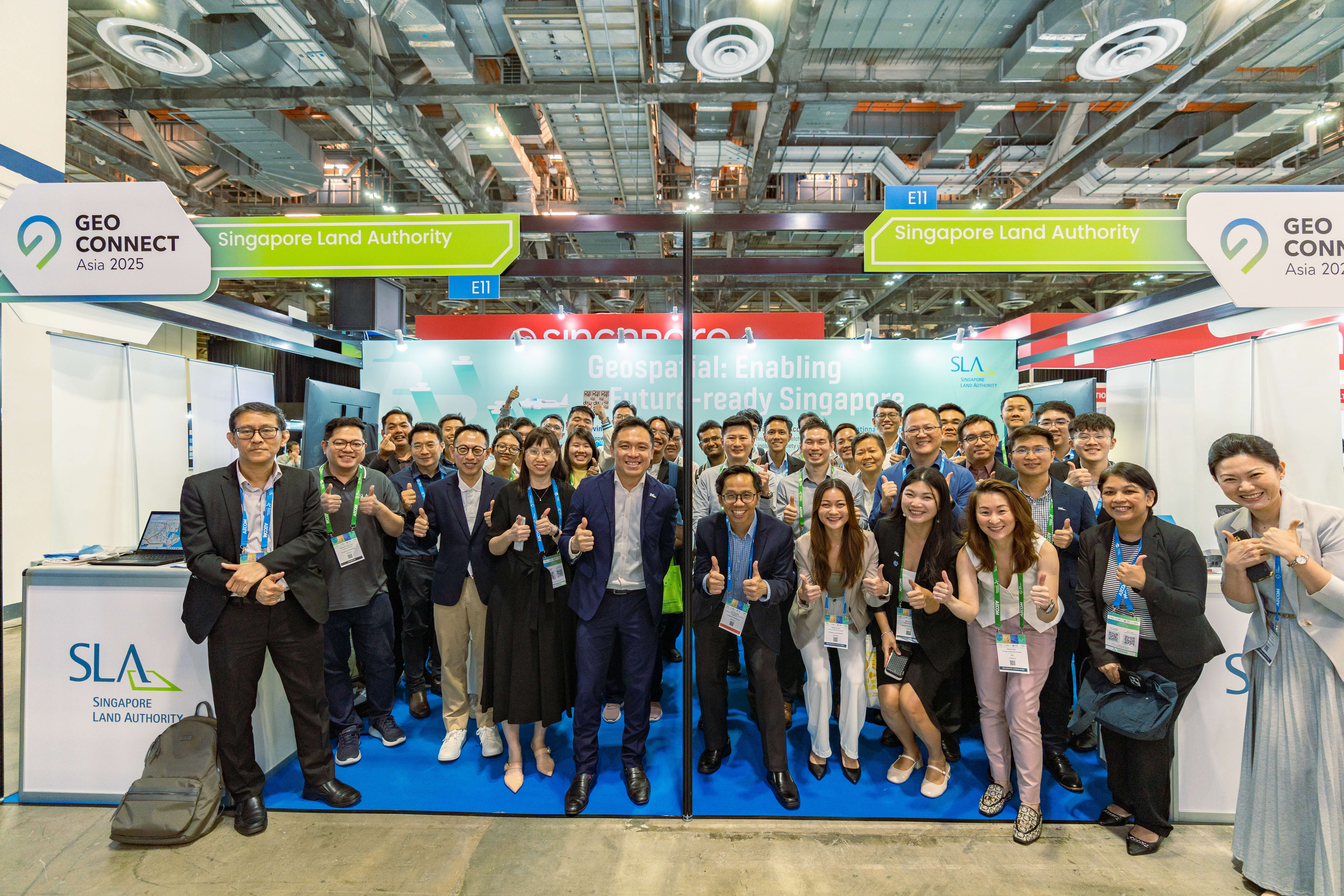
Mr Yeoh and delegates also toured the exhibition, starting with SLA’s booth featuring its initiatives and products including Barrier-Free Access, LAMP, Digital Underground, the National 3D Mapping Programme, and SiReNT – Singapore’s national satellite positioning infrastructure. The delegation then visited the Thailand and Sabah Pavilions, and concluded with showcases by a few prominent leading companies.
Panel: Geo + Augmented Intelligence: Transforming Data into Actionable Insights
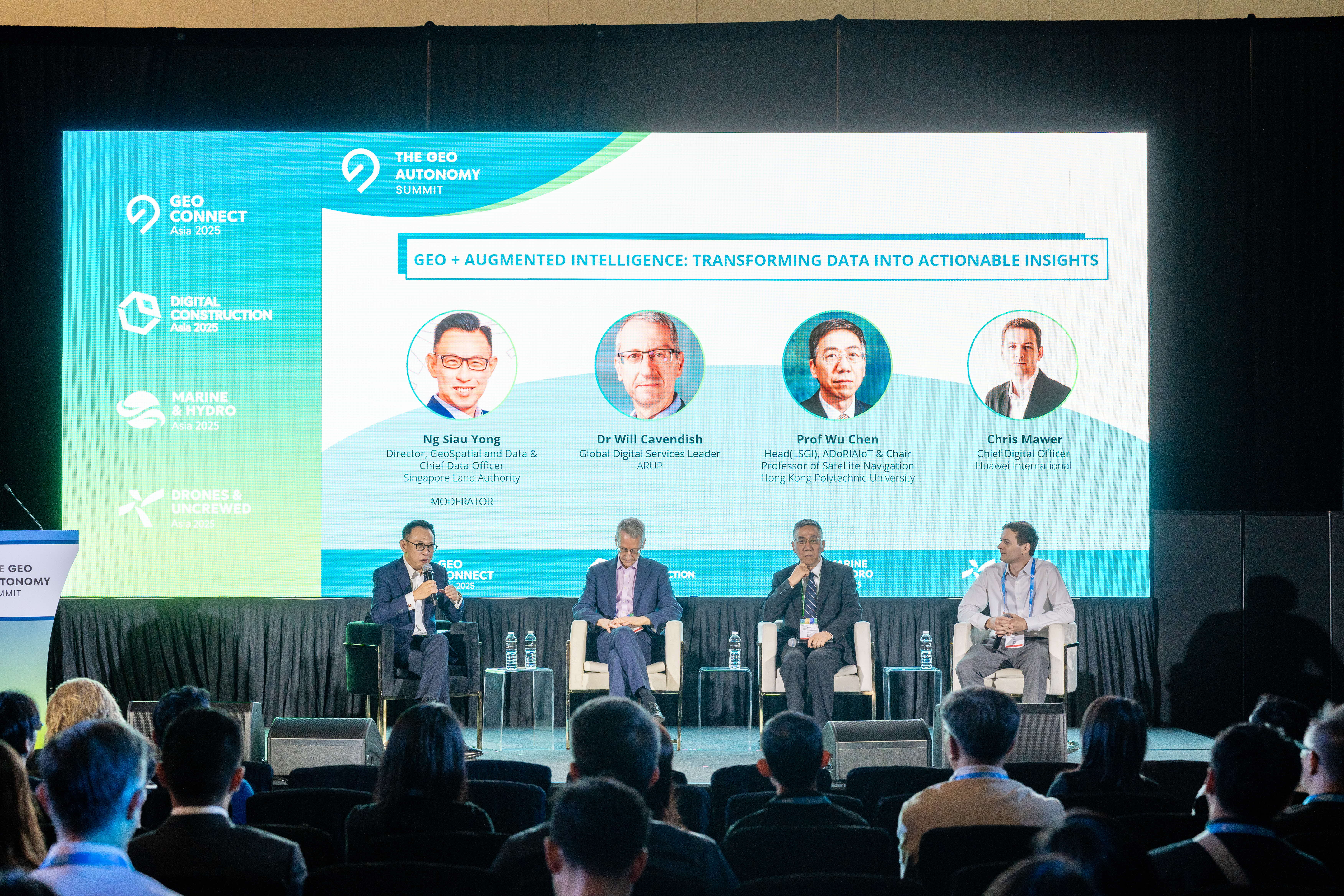
On Day 1 of Geo Connect Asia 2025, a panel featuring
-
Prof. Wu Chen, Head LSGI, ADoRIAIoT & Chair Professor of Satellite Navigation of The Hong Kong Polytechnic University,
-
Dr Will Cavendish, Director, Global Digital Services Leader of Arup,
-
Mr Chris Mawer, Chief Digital Officer of Huawei International
with Mr Ng Siau Yong, Director, GeoSpatial and Data & Chief Data Officer of SLA as moderator, unpacked how geospatial intelligence, AI, and open data are shaping the future.
"The issue isn’t data scarcity—it’s data quality," said Mr Ng, as he opened the discussion on the urgent need for usable, integrated insights in today’s decision-making.
"Real-world AI isn’t about clean datasets—it’s training models to thrive in messy, complex realities," opined Dr Cavendish, who shared how AI is helping cities balance cost and reduce carbon footprint, and even repurpose ageing buildings with vibration and noise analysis.
Prof Chen spotlighted Hong Kong’s spatial data infrastructure, enabling tools like LLMs to assess road planning and environmental impact.
Mr Mawer called for open-source formats to fuel innovation, as the panel closed with a rallying cry to geospatial professionals: don’t silo your data— collaborate and blend it to solve global challenges!
Digital Underground Connect 2025 (DUConnect)
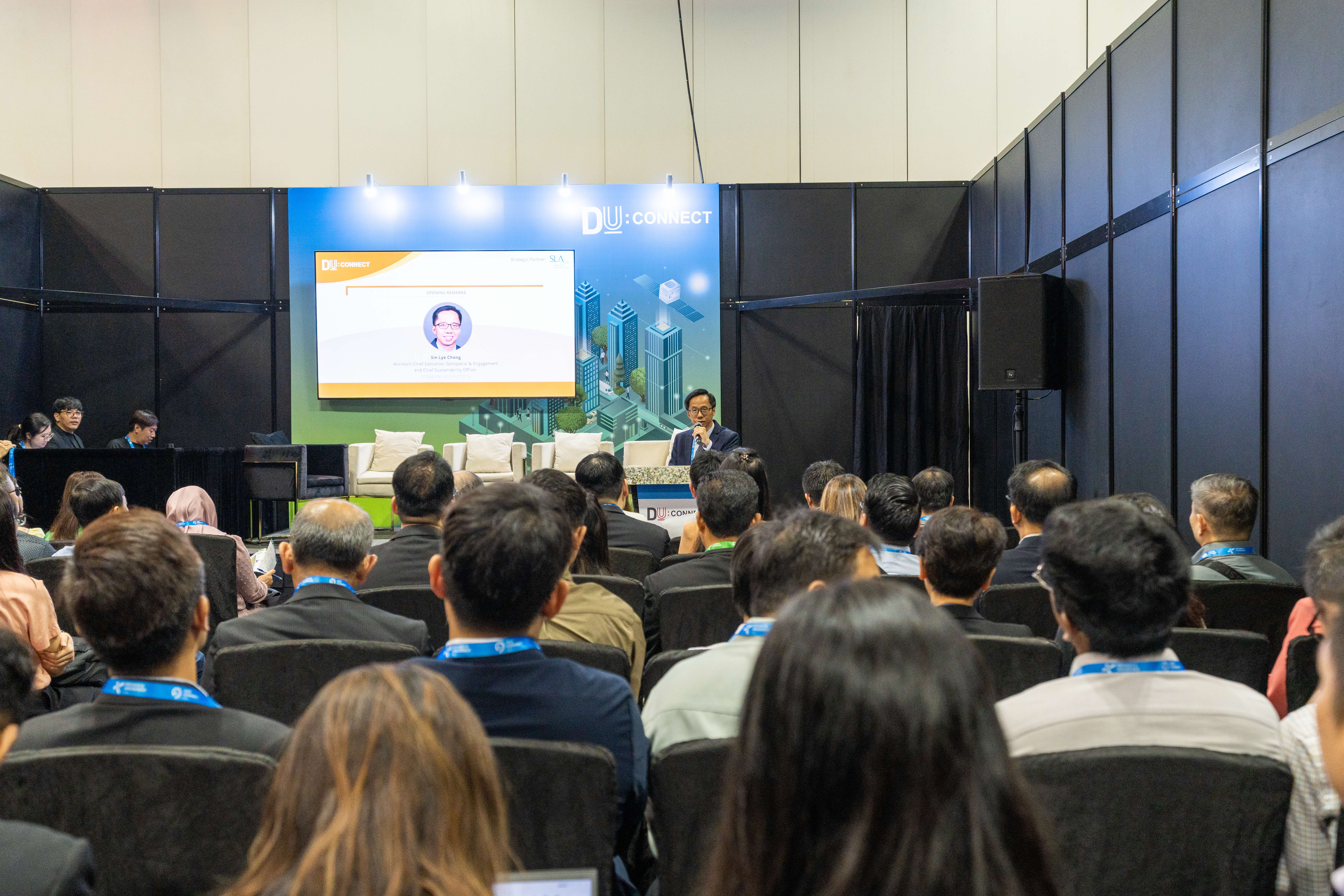
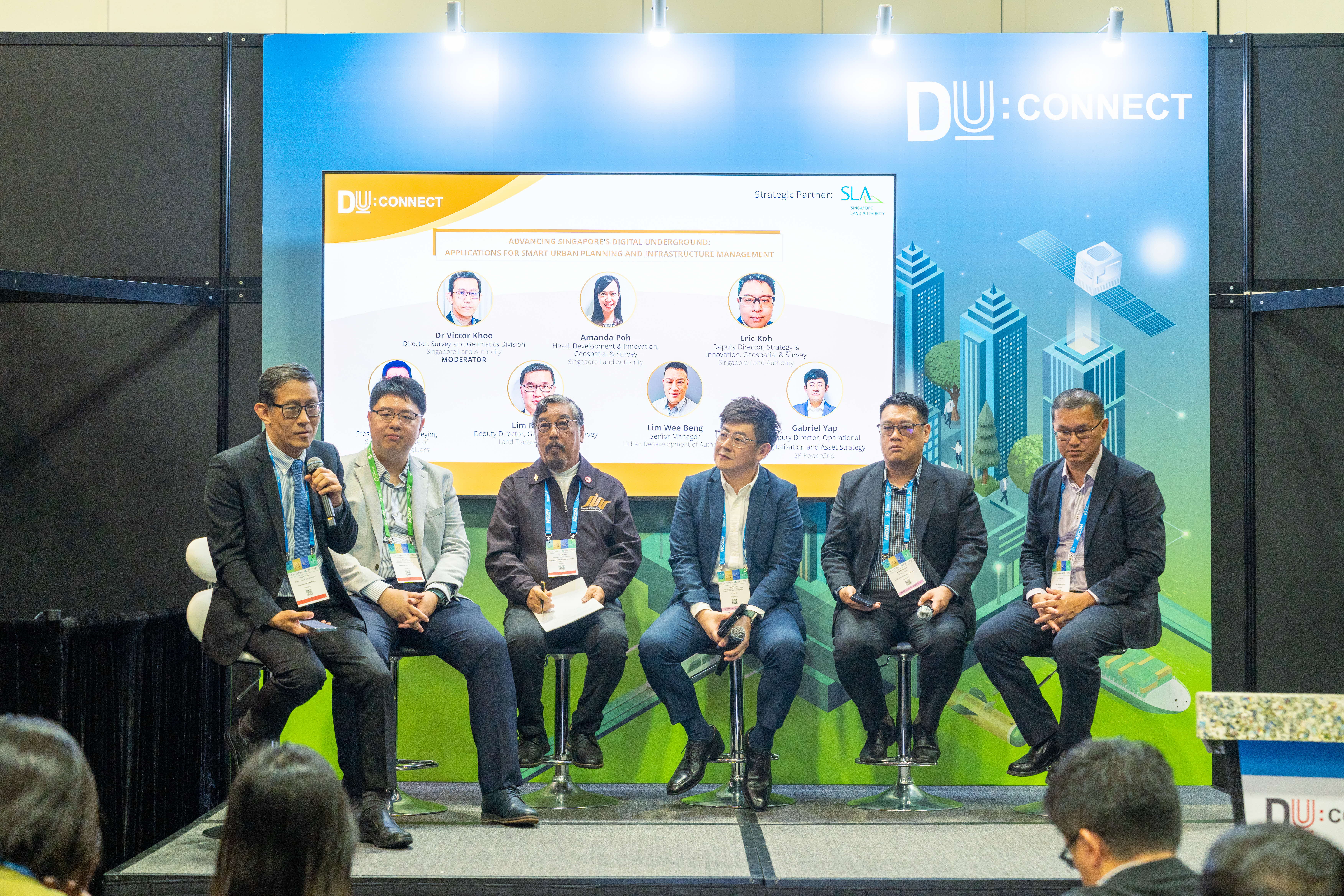
Digital Underground Connect 2025 commenced with an Opening Remarks by Mr Sin Lye Chong,
Assistant Chief Executive, Geospatial & Engagement & Chief Sustainability
Officer of SLA. More than 20 experts came together across four dynamic
panels to explore the untapped potential of Singapore’s subsurface. The
conversations underscored a clear vision: building a smarter, safer, and
more sustainable city starts with understanding what’s underground.
Strong public-private partnerships and reliable underground data are key
to shaping an accurate digital twin of our underground spaces. By breaking
down silos and sharing up-to-date information, we can transform buried
infrastructure into a collective asset—supporting better decision-making,
reducing risks, and unlocking new possibilities for urban innovation.
Powerful ideas and partnerships emerged at DUConnect 2025—we’re just beginning
to dig into the future.
The Asian Aerial Mapping Forum 2025
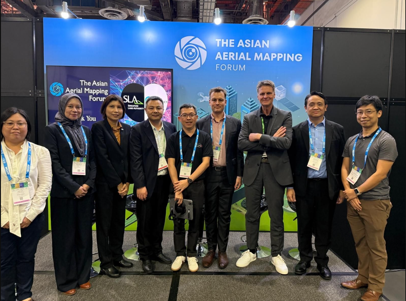
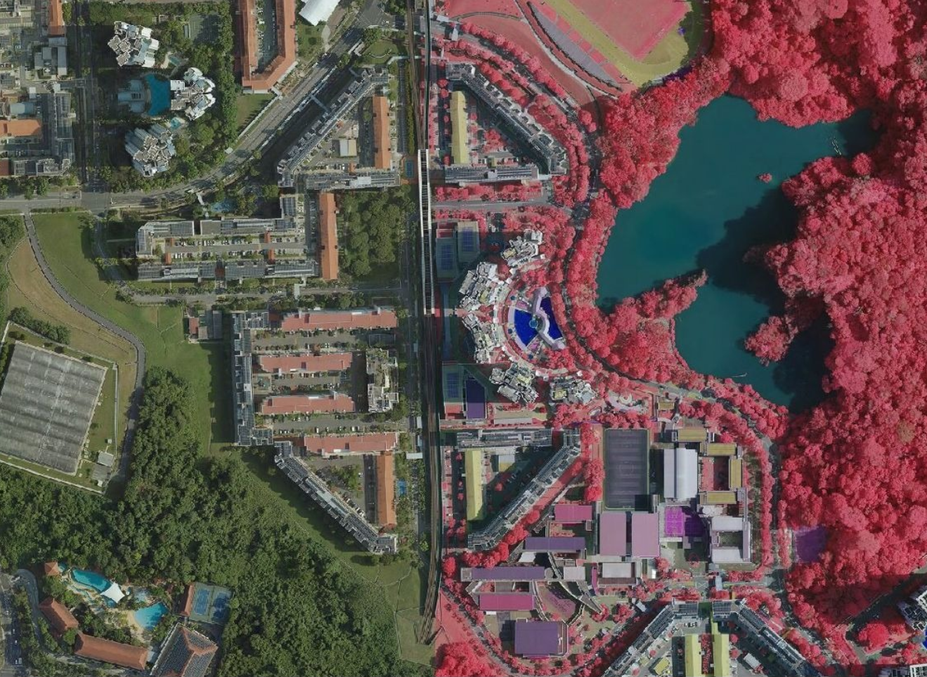
While one forum took us deep into the Digital Underground, the other had us gazing skyward during the inaugural Asian Aerial Mapping Forum.
From the first aerial photo snapped via hot air balloon in 1858 to today’s AI-enhanced LiDAR scans and drone imagery, aerial mapping has become a cornerstone of urban digital twins. It’s the birds-eye foundation that lets us capture building geometries, terrain features and infrastructure with pinpoint accuracy.
The forum brought together a stellar panel of experts across industry, academia, and the public sector, offering fresh insights, best practices, and novel applications that show how these "eye-in-the-sky" technologies are transforming how we plan our urban future in the areas of land and infrastructure management, resource optimisation, and environmental monitoring.
Closing Plenary: Mainstreaming Geospatial for Good: From Niche to Necessity
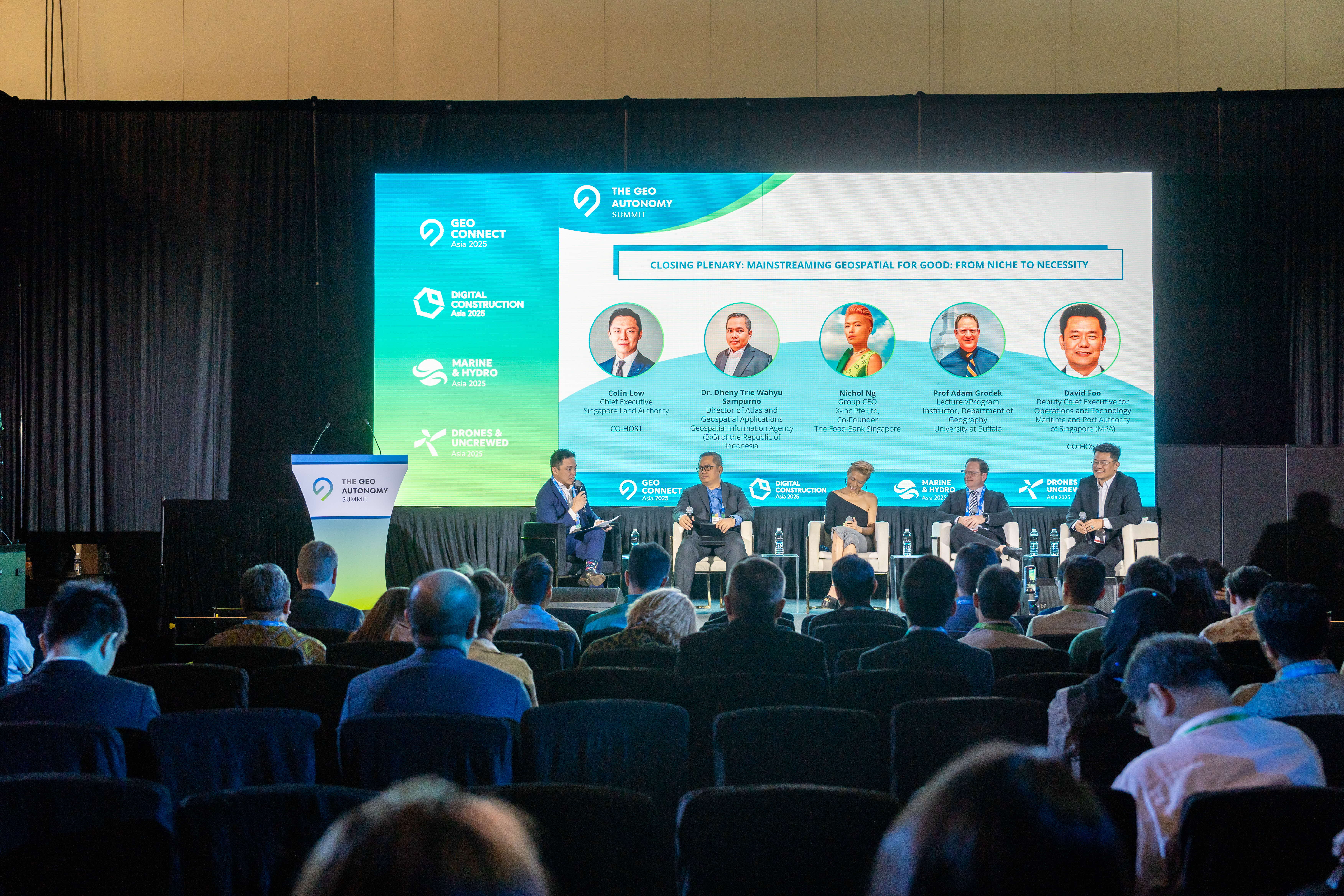
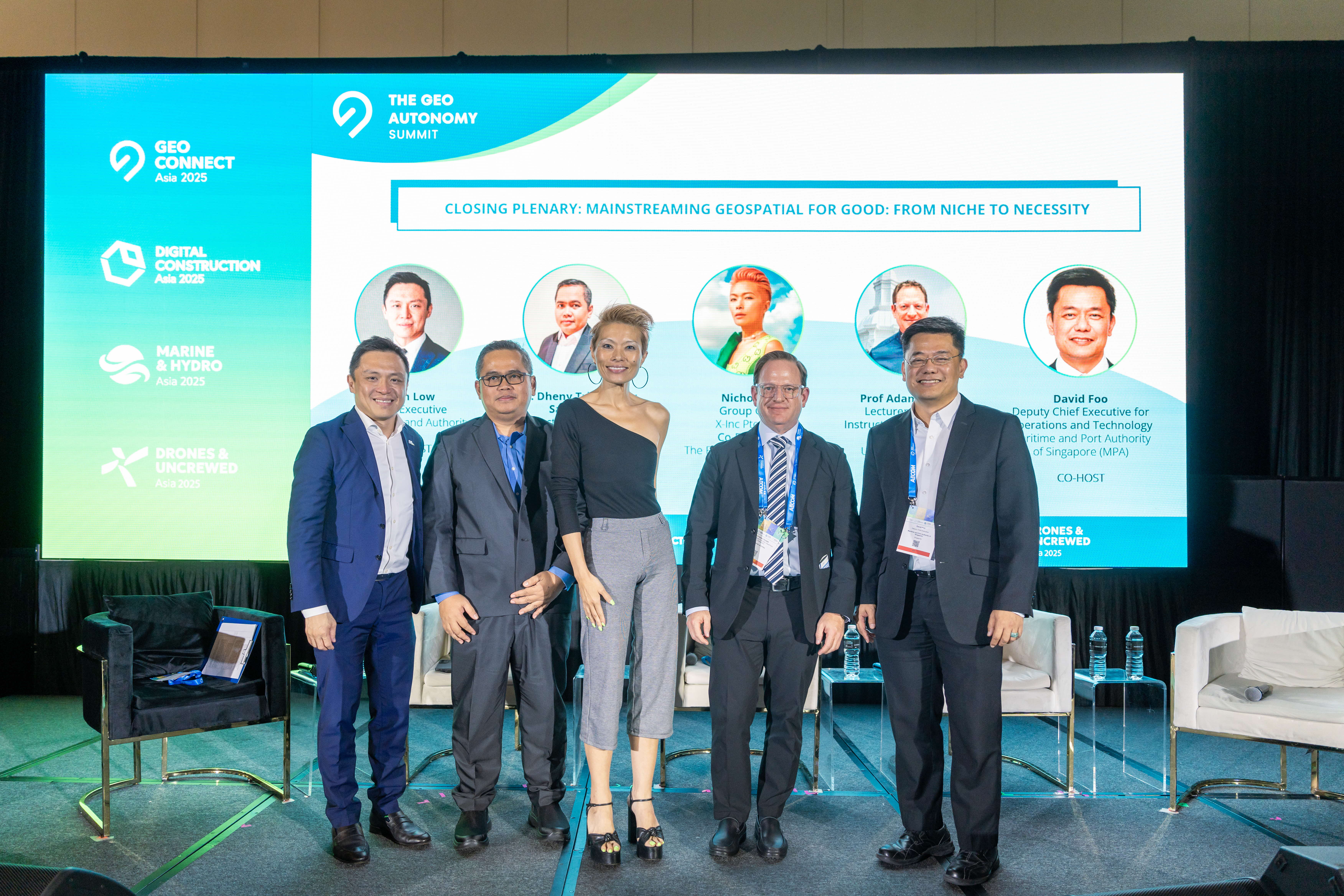
The Geo Connect Asia 2025 concluded with an expert panel discussion featuring (from left to right):
-
Co-Host: Mr Colin Low, Chief Executive, Singapore Land Authority
-
Panellist: Dr. Dheny Trie Wahyu Sampurno, Director of Atlas and Geospatial Applications, Geospatial Information Agency (BIG) of the Republic of Indonesia
-
Panellist: Ms Nichol Ng, Group CEO, X-Inc Pte Ltd; Co-Founder, The Food Bank Singapore
-
Panellist: Prof. Adam Grodek, Lecturer / Program Instructor Department of Geography, University at Buffalo
-
Co-Host: Mr David Foo, Deputy Chief Executive for Operations and Technology, Maritime and Port Authority of Singapore
The speakers unpacked what it takes to scale geospatial solutions that are inclusive, impactful, and future-ready. Discussion topics included solution scalability, social impact initiatives, cross-sector collaboration, technological advancement, and talent development strategies.
Watch Closing Plenary video here.
We thank the organiser, Montgomery Asia for their strong support and our team for their dedication in delivering this successful event!
See you at Geo Connect Asia (31 Mar & 1 Apr 2026) next year!