

GeoEngage 2025
GeoEngage 2025: Socio-Healthcare Edition
In October, the Singapore Land Authority (SLA) organised GeoEngage 2025: Socio-Healthcare Edition, which brought together over 170 participants from government, academia, and the social-healthcare sector to explore how geospatial insights can enhance social service delivery and strengthen community care.
From the Living Asset Map that supports social prescribing to Barrier-Free Access Routing that enables inclusive mobility, this year’s event highlighted how geospatial tools can help us plan smarter, connect better, and create a more inclusive society.
Here’s a round-up of what went down on 7 and 8 October! 👇
Setting the Stage with Innovation 💡
“Each of you here is a trailblazer – showing how geospatial can be used in practical, meaningful ways to build stronger, healthier communities.”
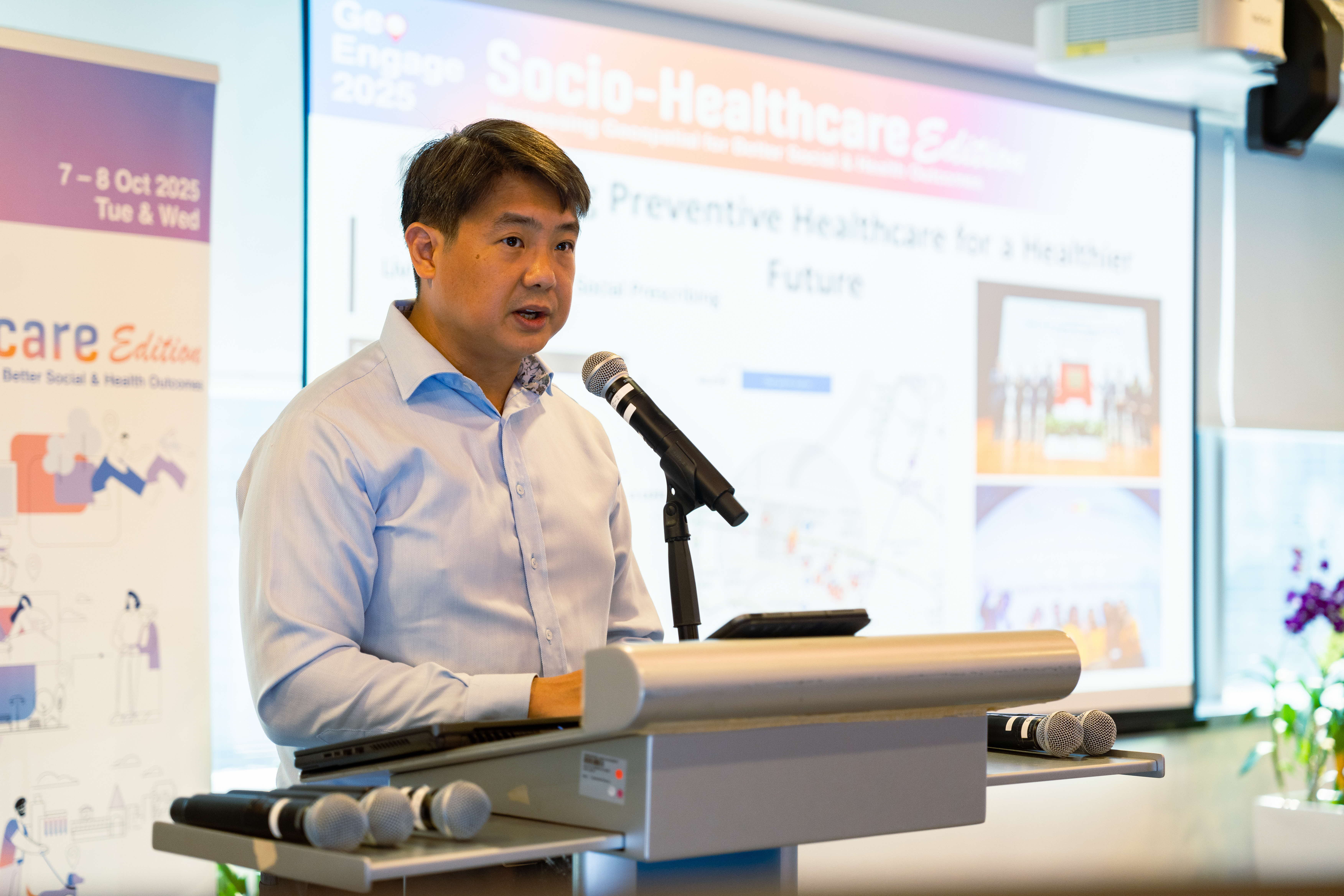
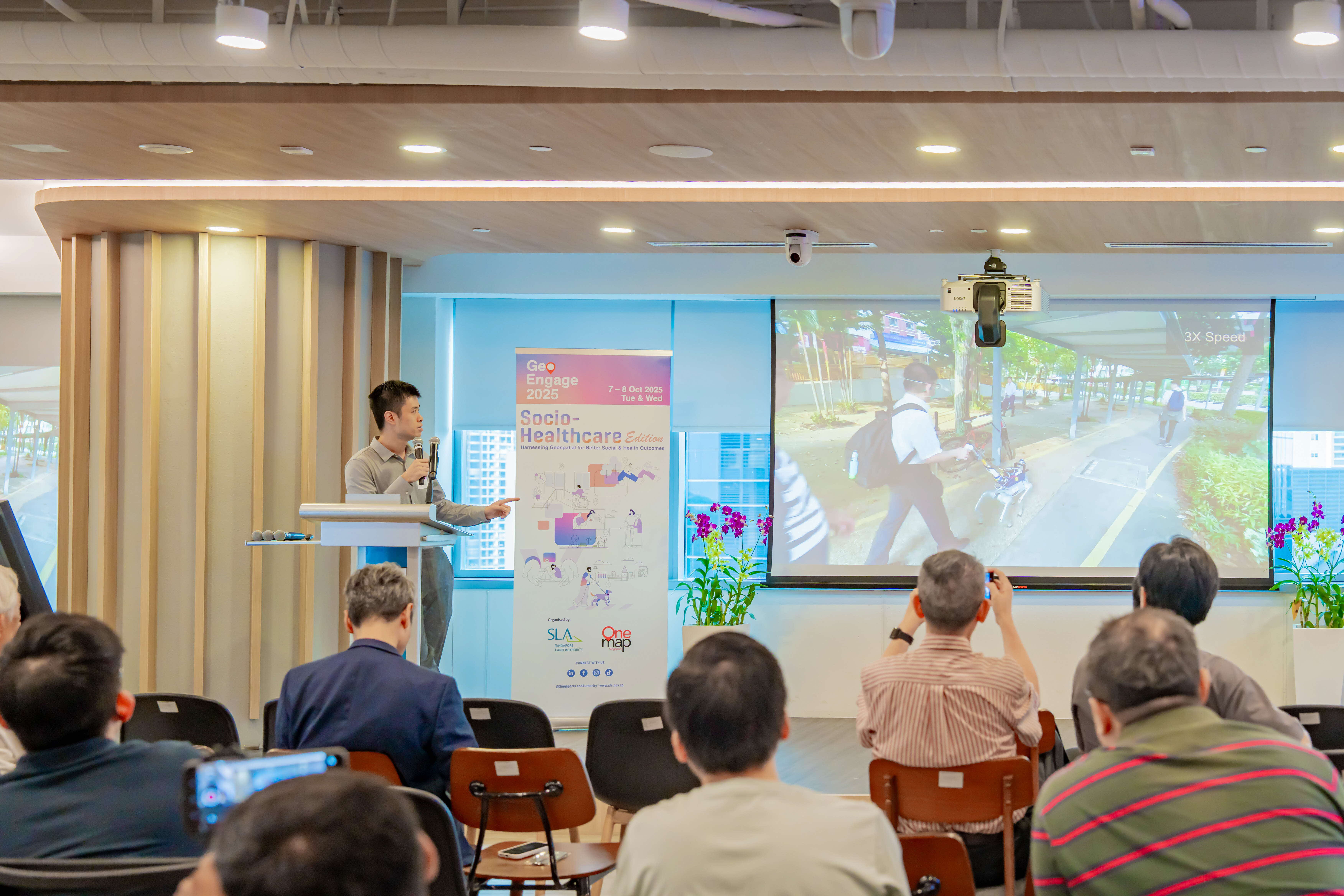
With this inspiring opening message, our Acting Assistant Chief Executive (ACE), Mr Benjamin Chan set the stage for two days of learning, sharing, and collaboration.
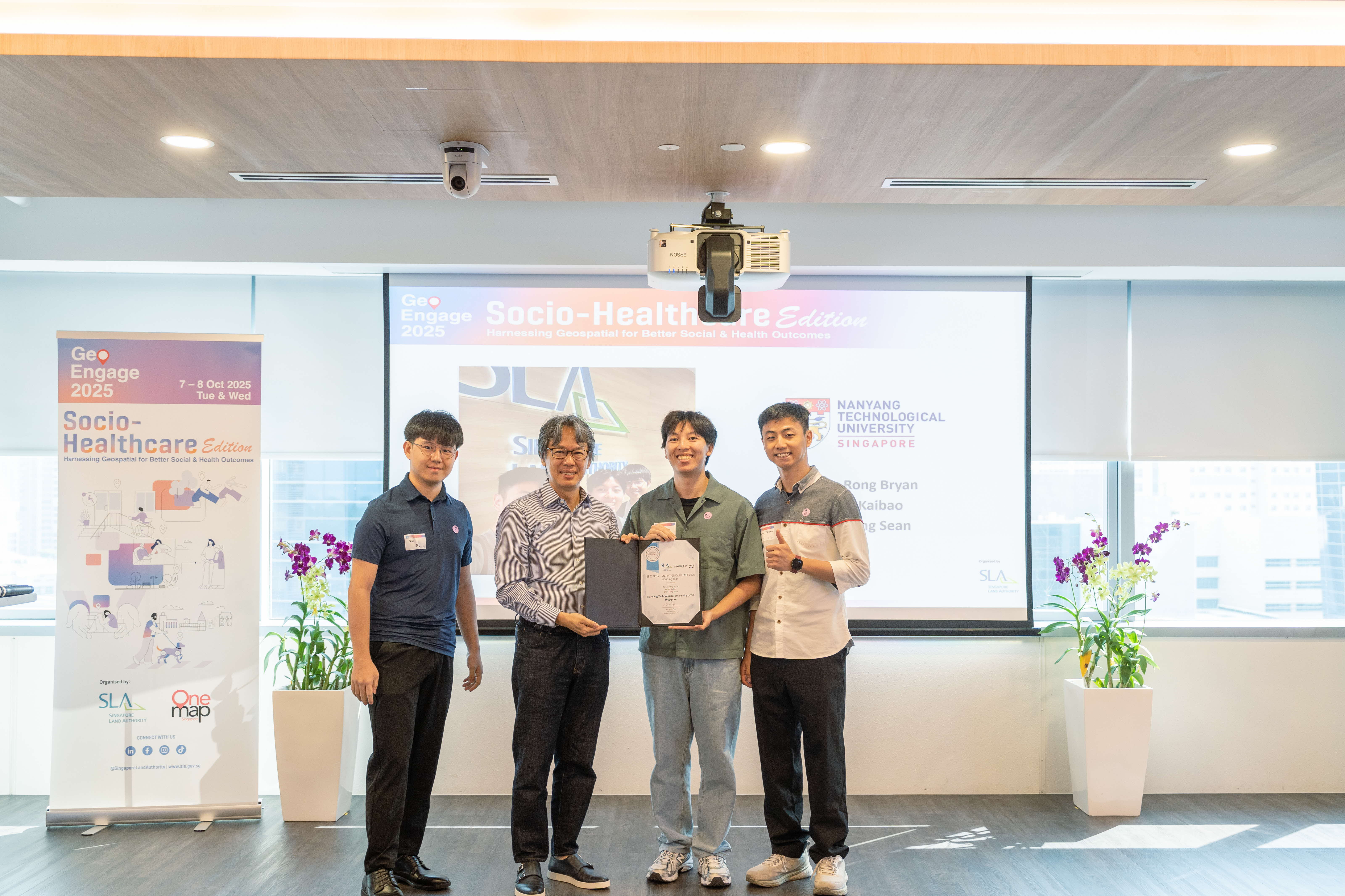
A highlight of the opening session was the award presentation for the Amazon Web Services (AWS) - SLA Geospatial Innovation Challenge – which invited students from Singapore’s IHLs to reimagine how OneMap and geospatial insights could address real-world socio-healthcare issues.
These student projects demonstrate how geospatial technologies can be harnessed to build stronger, healthier, and more inclusive communities.
ReMind: Supporting Dementia & Community-Assisted Eldercare
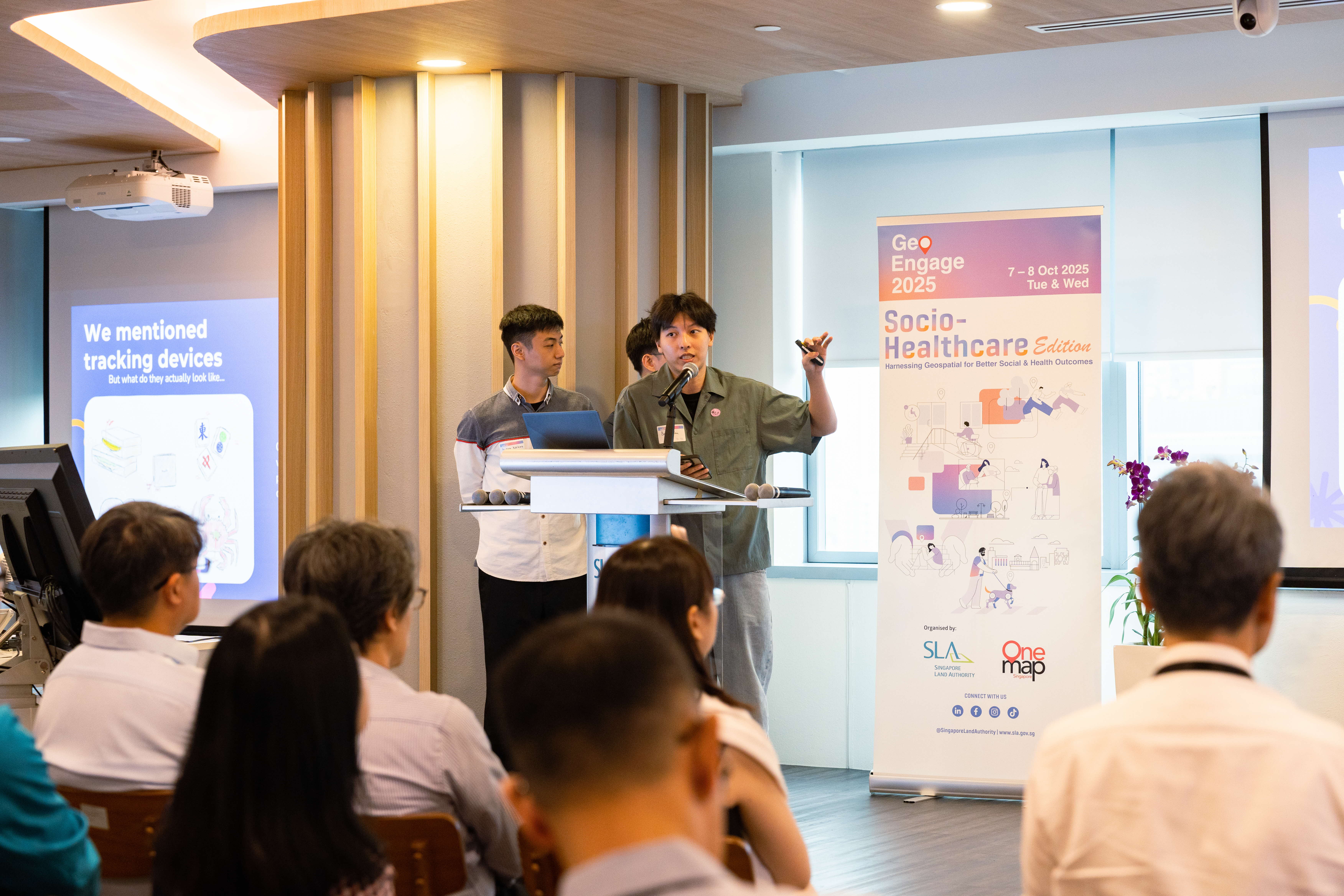
The top prize went to Team 1 from Nanyang Technological University (NTU). The team developed a mobile app, ReMind, that uses OneMap’s geospatial data for real-time tracking and routing of seniors who may wander from their safe zones. The app alerts caregivers when individuals move beyond designated areas and guide them via the fastest route to locate them. ReMind also mobilises nearby community responders to locate and share sightings of missing persons, guiding them to Dementia Go-to Points on OneMap and forming a community-centric safety network
Other Participating Teams (not in order of merit)
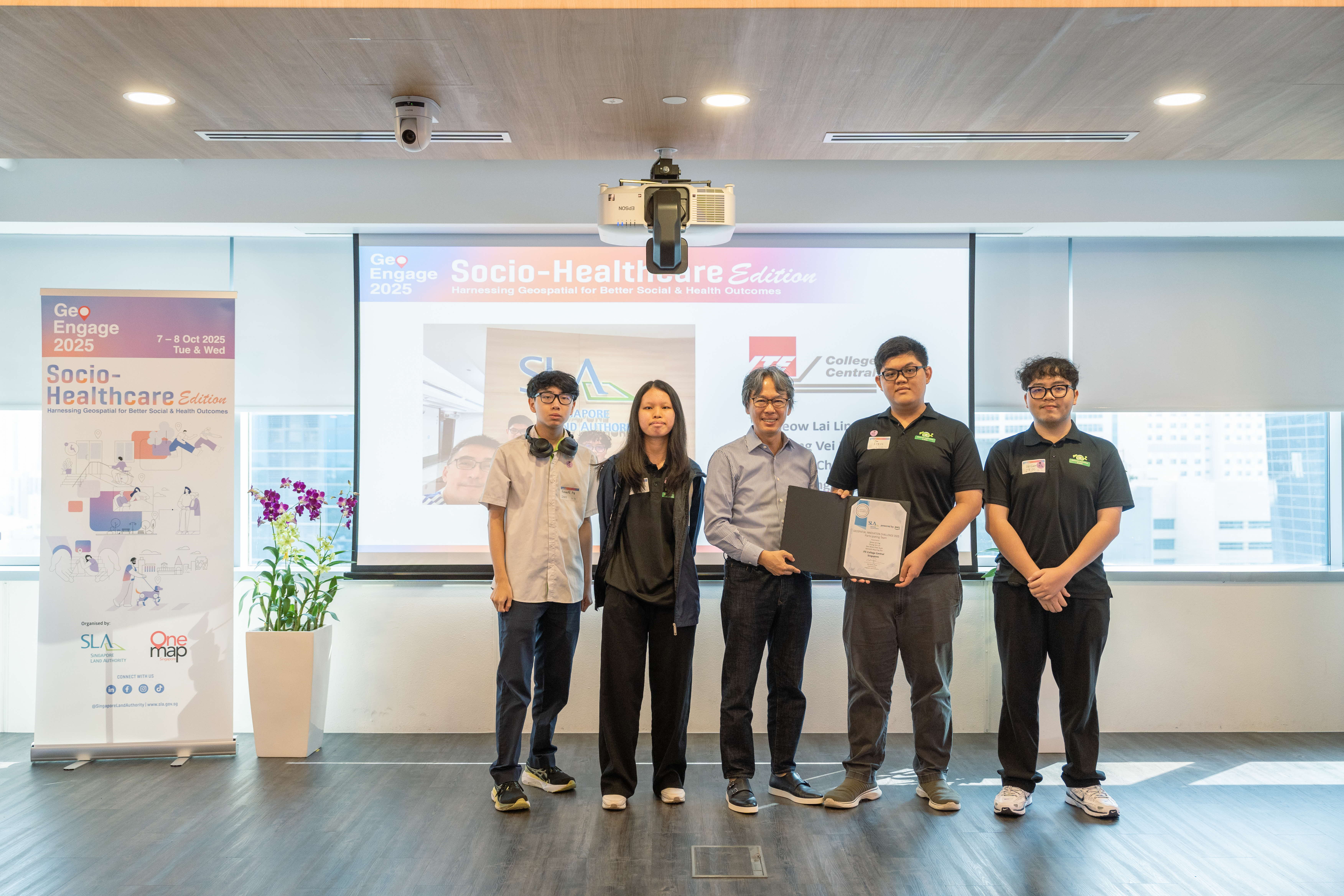
Purposeful Event: Gamifying Wellness for Active Ageing by Institute of Technical Education (ITE)
The team’s prototype, Purposeful Event, encourages seniors to remain socially and physically active by connecting them to nearby community activities through a gamified OneMap interface. By blending geospatial mapping with behavioural design, Purposeful Event helps create more connected, active, and inclusive communities for seniors.
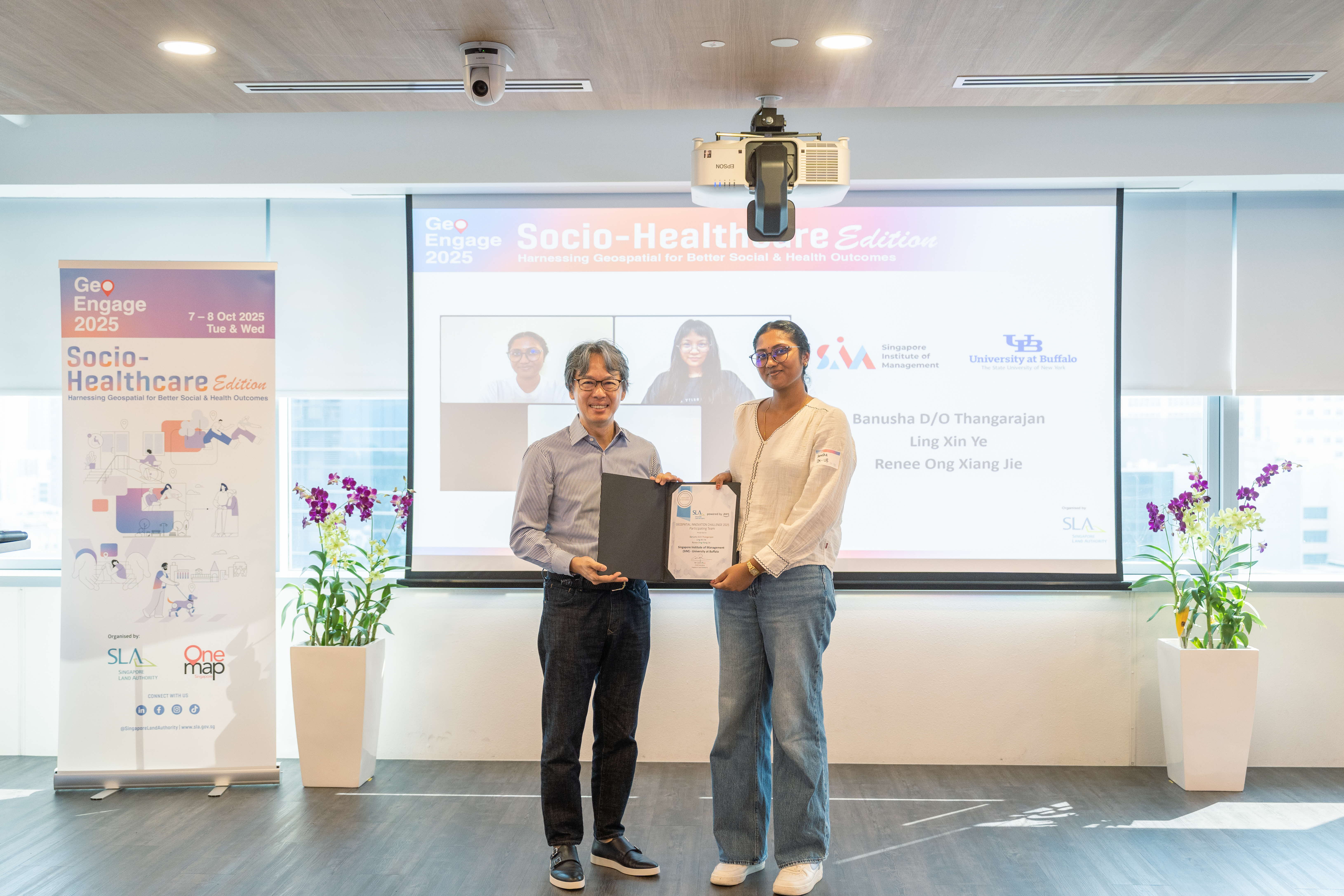
CareLink: Targeted Aid Distribution & Outreach for Vulnerable Communities by Singapore Institute of Management (SIM)
In 2024, Singapore generated 784,000 tonnes of food waste, even as some households continued to experience food insecurity. The team’s prototype, CareLink, bridges this gap through OneMap that links local mini-marts and shops with residents in need, especially among elderly residents and low-income families. The system visualises areas of higher food insecurity, enabling community organisations to plan more efficient and equitable outreach. By combining sustainability and social support, CareLink turns waste reduction into a community-driven aid network, using geospatial intelligence to match surplus to need.
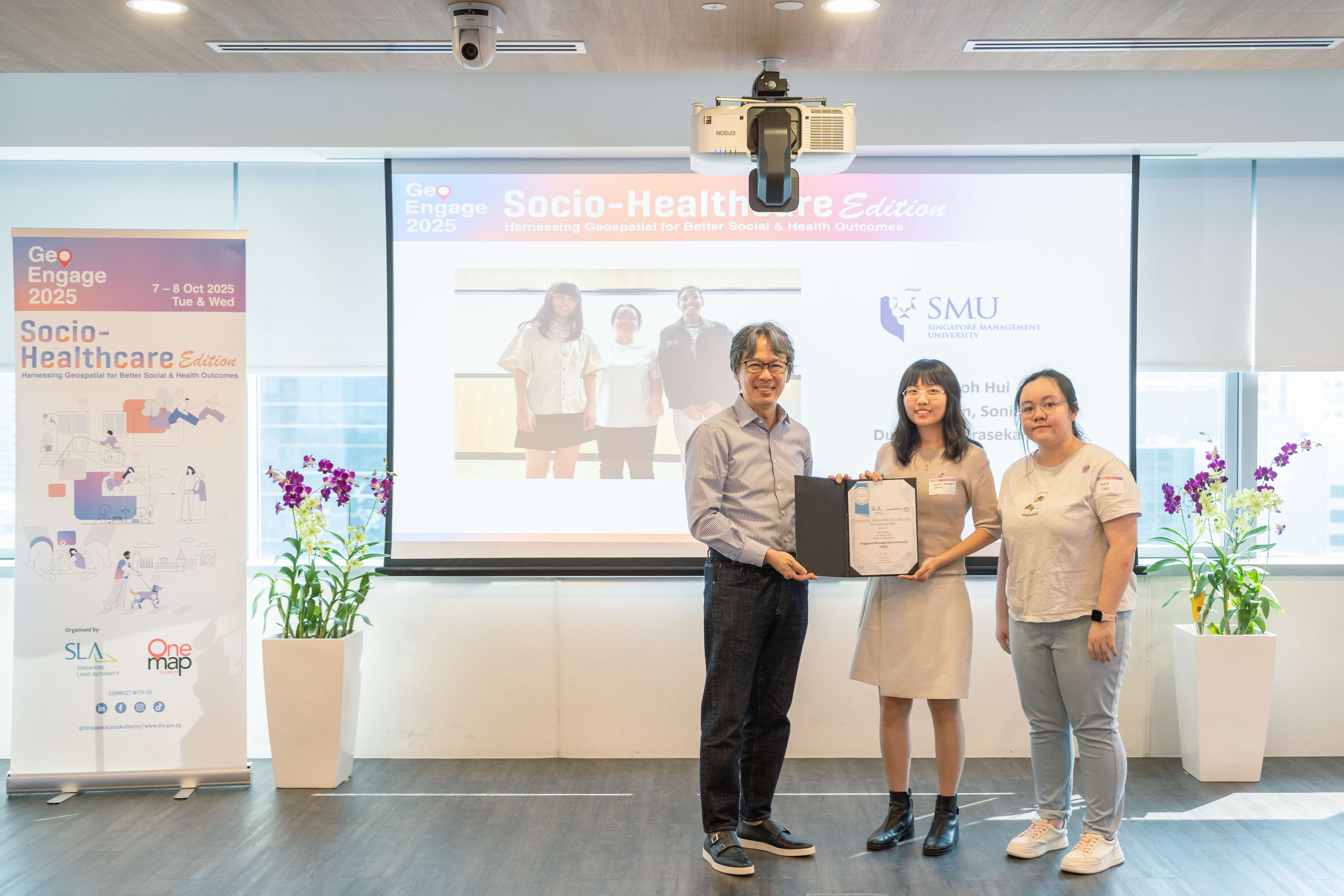
VapeWatch: Geospatial Insights to Identify and Respond to Emerging Vaping Hotspots By Singapore Management University (SMU)
With vaping cases rising to 2,500 in just the first half of 2025, the team designed VapeWatch, which demonstrates how geospatial intelligence can be used to strengthen public health surveillance, enforcement, and youth outreach. VapeWatch serves as a connected ecosystem linking citizens, enforcement agencies, outreach workers, and community partners through a shared geospatial data platform. Citizens can submit anonymous vaping incident reports through a mobile app, verified by AI-based photo recognition to improve reliability, while officers can access an operational dashboard with incident maps, temporal pattern analysis, and AI-generated patrol recommendations, to identify hotspots and optimise resource deployment.
Insights that Inspired 💬
Across both days, we heard from experts in the socio-healthcare space who shared how geospatial insights are helping them better understand and serve communities.
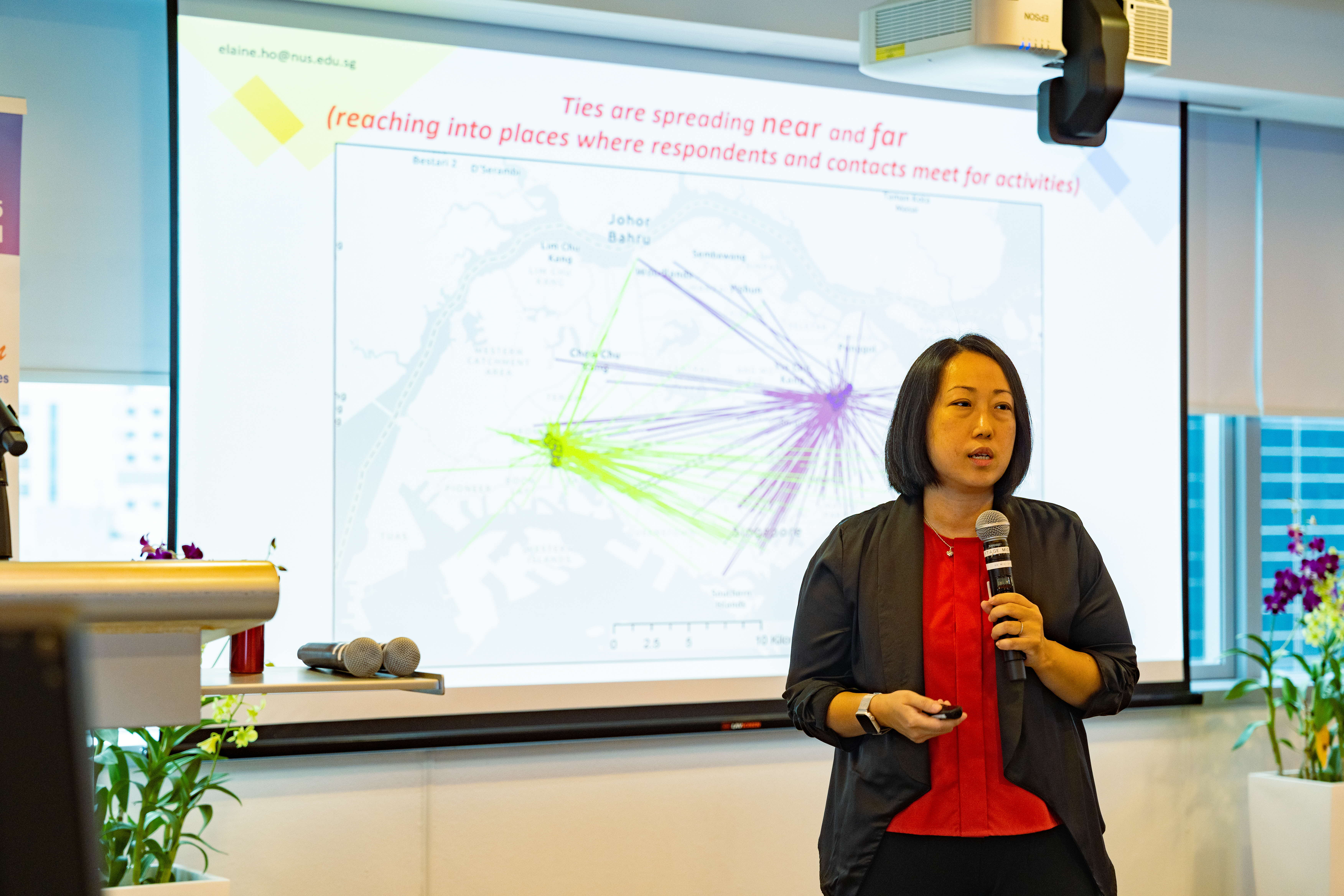
Ageing and Social Networks: Mapping the Life-Worlds of Older Singaporeans
Professor Elaine Ho from the National University of Singapore (NUS) shared her research findings, which reshapes how we think about active ageing in Singapore. Through survey data and compelling case studies, her work demonstrates how understanding older Singaporeans' movement patterns can guide planners in creating age-friendly environments that extend far beyond traditional residential areas, enabling seniors to remain active and engaged throughout the city.
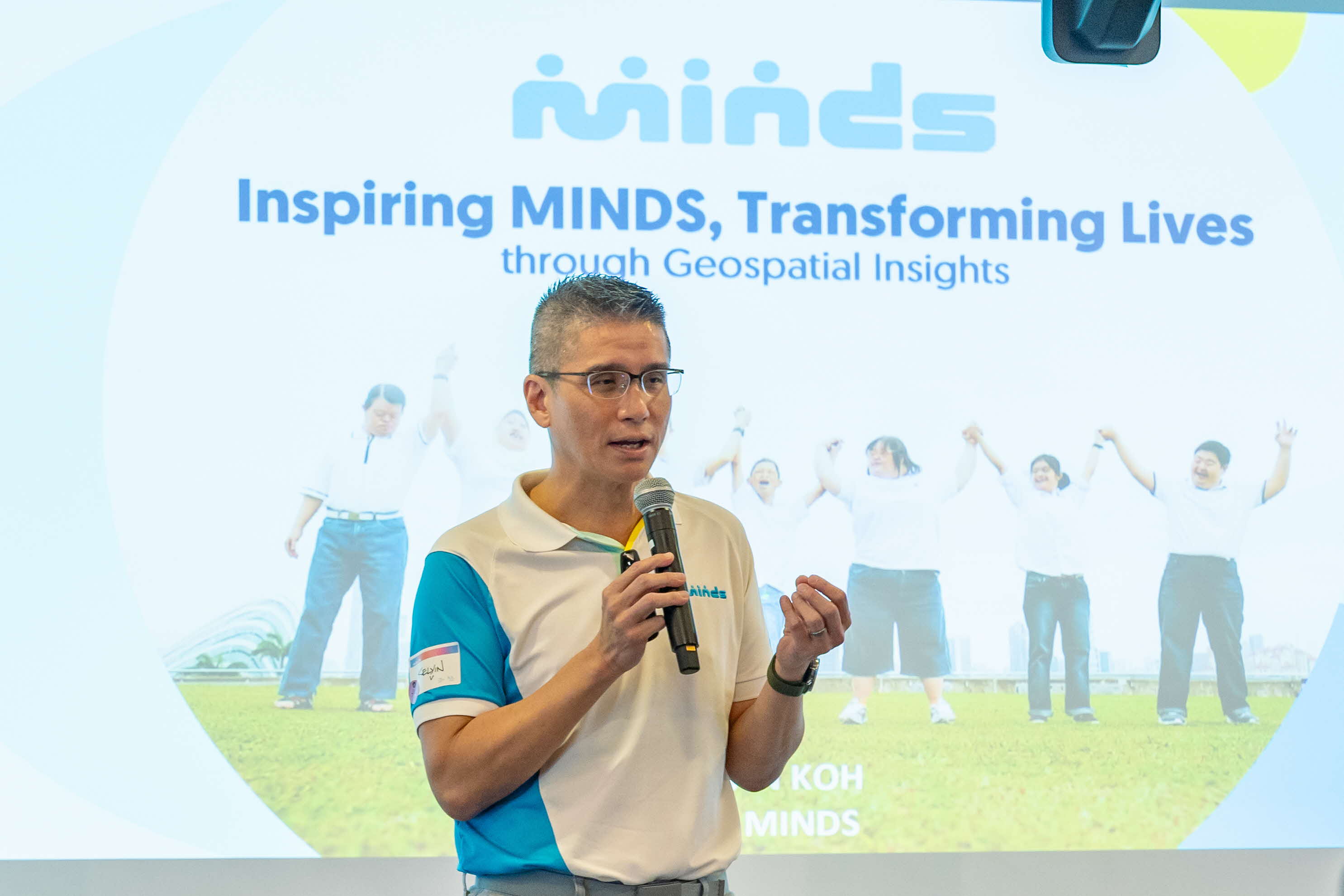
Inspiring MINDS, Transforming Lives through Geospatial Insights
Mr Kelvin Koh, Chief Executive Officer of the Movement for the Intellectually Disabled of Singapore (MINDS), shared how the organisation uses geospatial analysis to understand clients, make informed decisions for growth and expansion, and optimise client placement to address transportation concerns whilst leveraging existing services. Through the mapping analyses, the organisation visualises service accessibility and client distribution patterns, enabling more targeted and effective support for the intellectually disabled community.
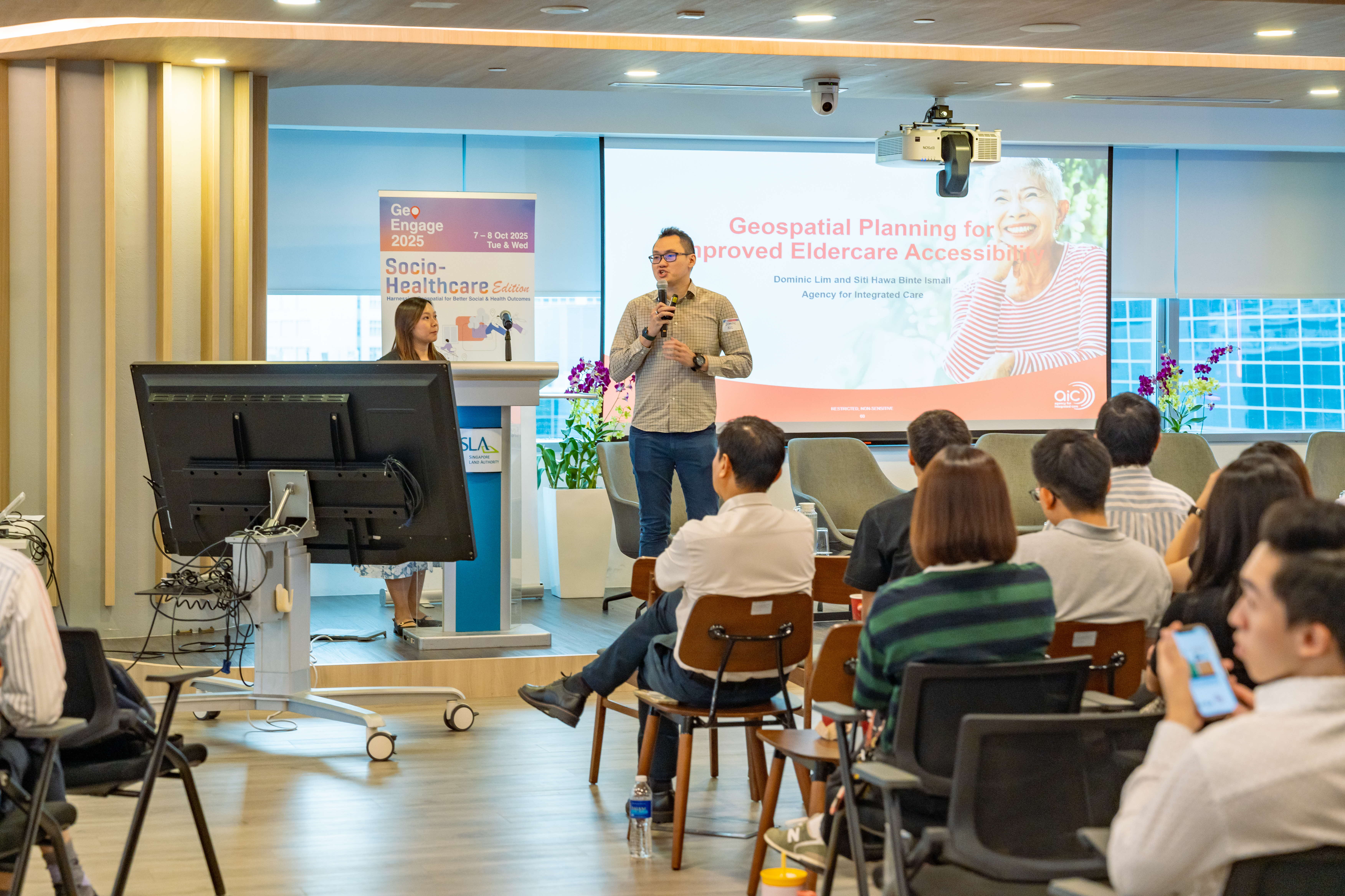
Geospatial Planning for Improved Eldercare Accessibility
Mr Dominic Lim, Head of Planning and Policy-Operations, and Ms Siti Hawa Binte Ismail, Assistant Manager from the Strategy, Research and Data Division at the Agency for Integrated Care (AIC), presented their community asset mapping solution This visualisation tool is transforming how AIC approaches senior care by optimising service planning, delivery and placement to ensure every senior age well and thrive in their community.
Understanding Residents' Needs Through Geospatial Analysis
Mr Yet Tun Hoong, Assistant Director of Community Development at Viriya Community Services, showcased an innovative interactive community mapping application that transforms how organisations understand and serve their communities. The platform harnesses geospatial technology to assess residents' wellbeing needs, enabling teams to identify and support high-risk community members with timely interventions. Beyond needs assessment, the application's interactive features help users locate nearby amenities and resources, streamlining service planning while fostering community engagement.
RoamAssist: Guide Dog of the Future
Mr Cai Shaojun, Chief Executive Officer of RoamAssist, demonstrated how the organisation is using geospatial technology to create robotic guide dogs for visually impaired users. This innovative device helps people navigate safely and independently by detecting obstacles and providing real-time guidance, offering a new level of freedom for those with visual impairments.
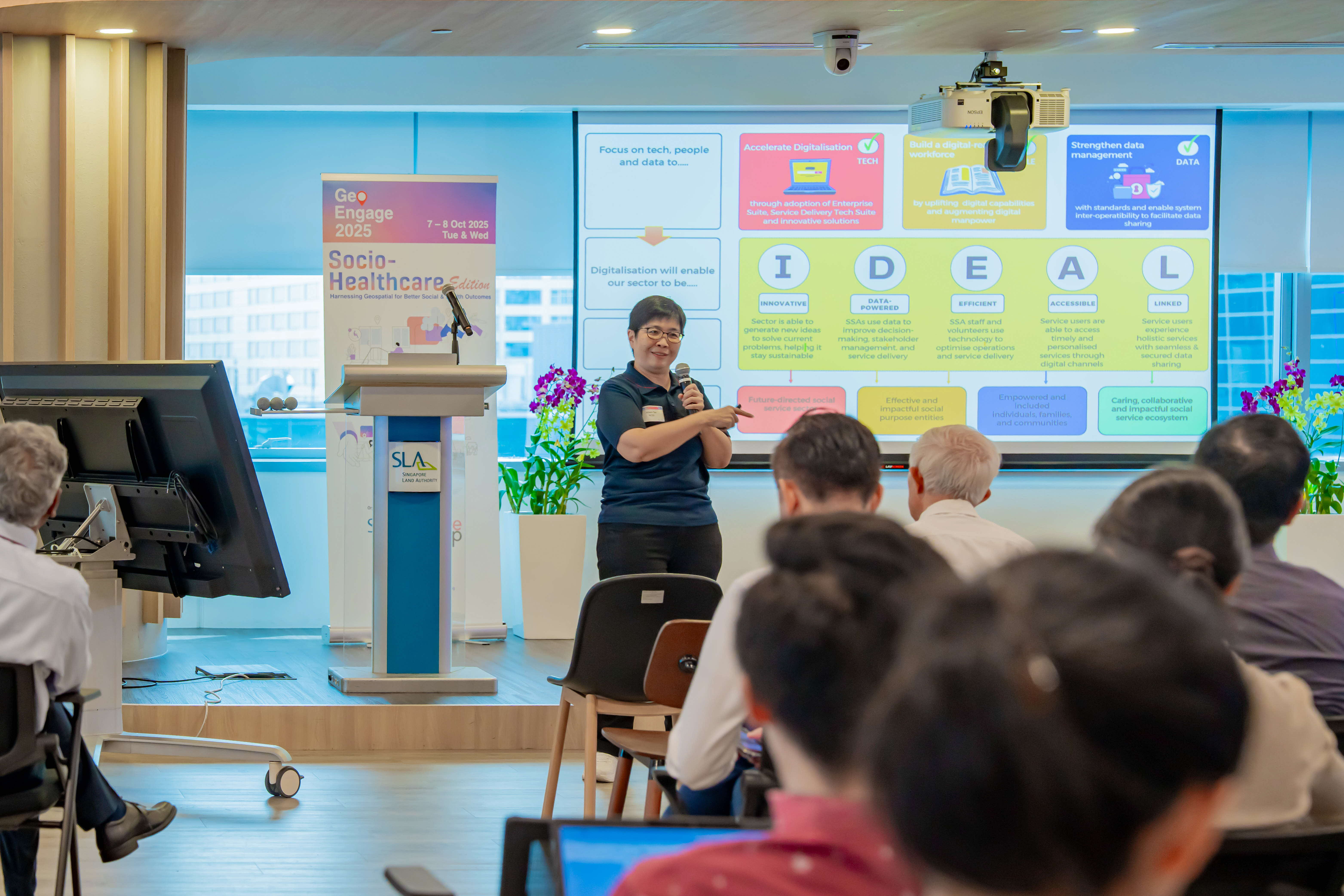
NCSS: Digital Transformation Roadmap for Singapore’s Social Service Sector
Ms Aileen Tan, Director of Capability Implementation and Digitalisation Strategy at the National Council of Social Service (NCSS), outlined the digital transformation roadmap for Singapore's social service sector. Through compelling use cases, she illustrated how technology can revolutionise service delivery while building organisational capabilities. NCSS's presentation served as both inspiration and practical guidance, encouraging social service agencies to embrace digitalisation and develop the technical expertise needed to better serve their communities in an increasingly connected world.
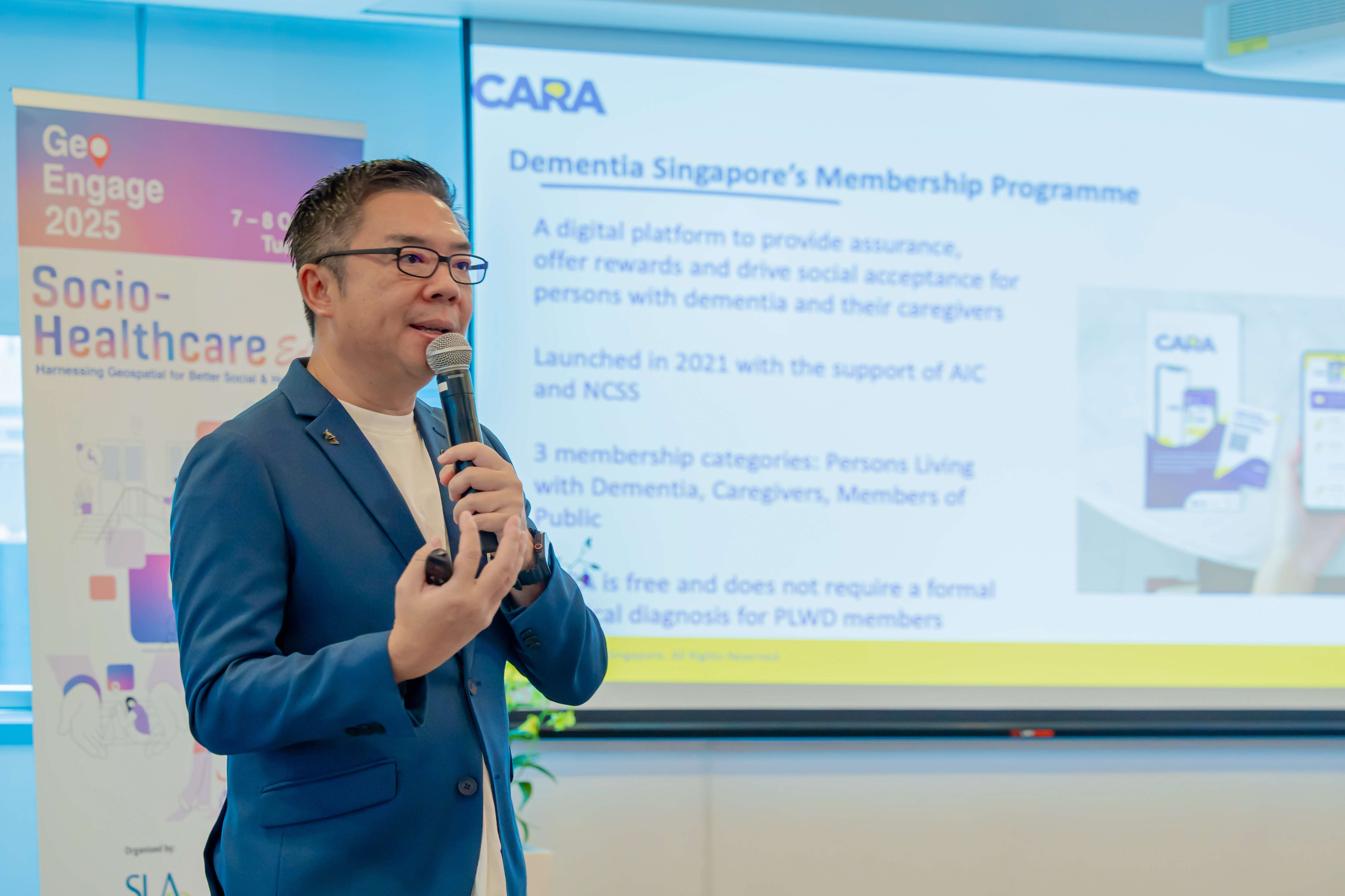
CARA - a Location-Enabled Lifestyle and Digital Community Platform
Mr Bernard Lim, Director of Advocacy & Communications at the Dementia Singapore, introduced CARA - the organisation’s lifestyle and digital community platform, that's transforming dementia care through innovative location technology. This solution harnesses location intelligence to safely trace missing dementia patients while maintaining a detailed map of over 800 dementia Go-To-Points (GTP) across Singapore. The platform's GTP locator feature empowers users to quickly identify the nearest support touchpoints, where specially trained staff stand ready to assist persons with dementia, creating a city-wide safety network that provides peace of mind for families and caregivers.
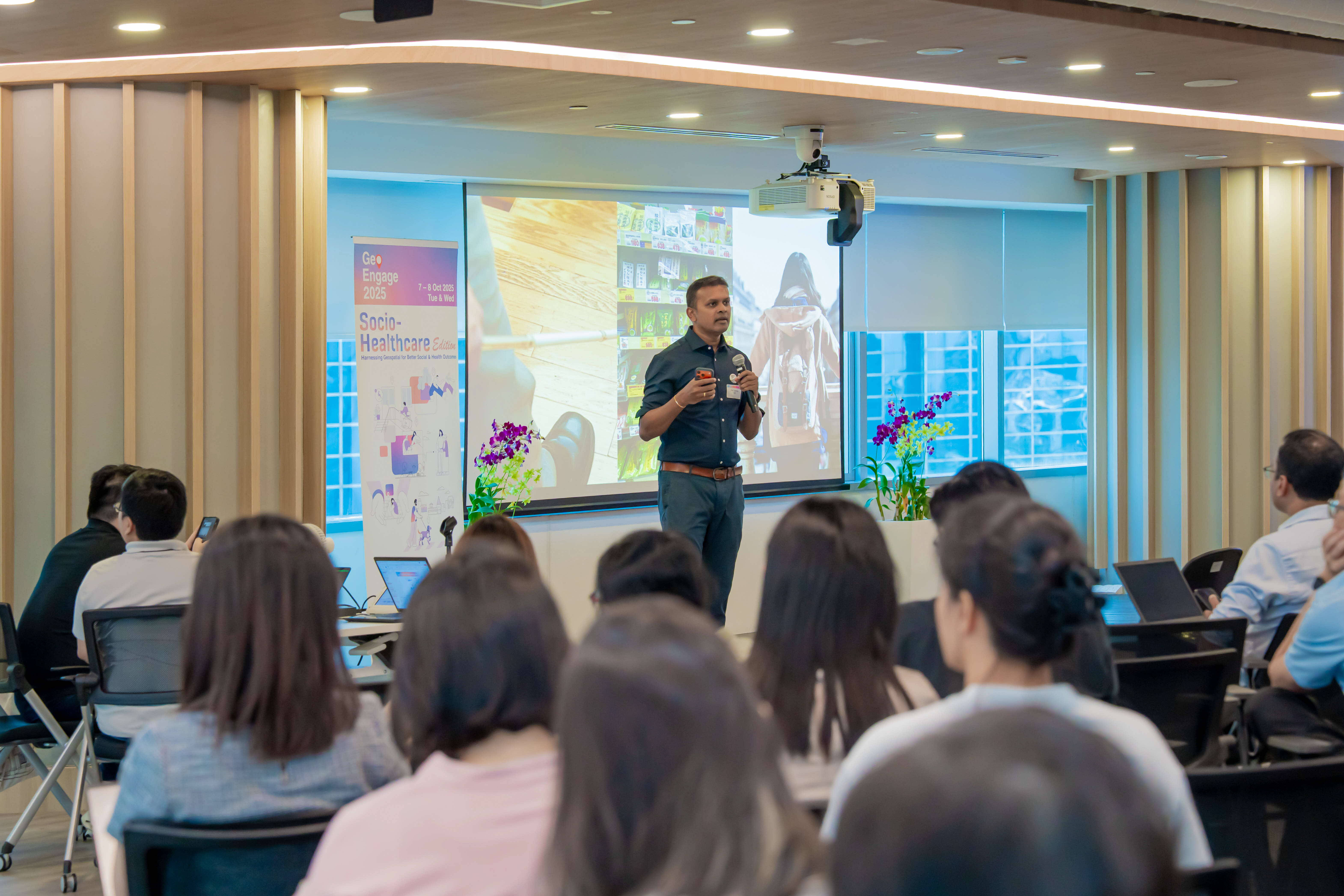
Assistive Augmentations – Fundamentally Transforming Human Ability
Professor Suranga Nanayakkara, Vice Dean (Communications), School of Computing at the National University of Singapore (NUS), showcased AiSee, an intelligent visual assistant, which is a wearable conversational companion that helps blind and low vision people to access information on the go. The device works by analysing images seen through a built-in camera and giving information about the object to the user through a verbal prompt. By combining assistive technologies with geospatial capabilities, AiSee empowers visually impaired users to navigate the world with greater confidence and independence, turning everyday environments into accessible, information-rich spaces.
Conversations that Mapped the Way Forward 🌍
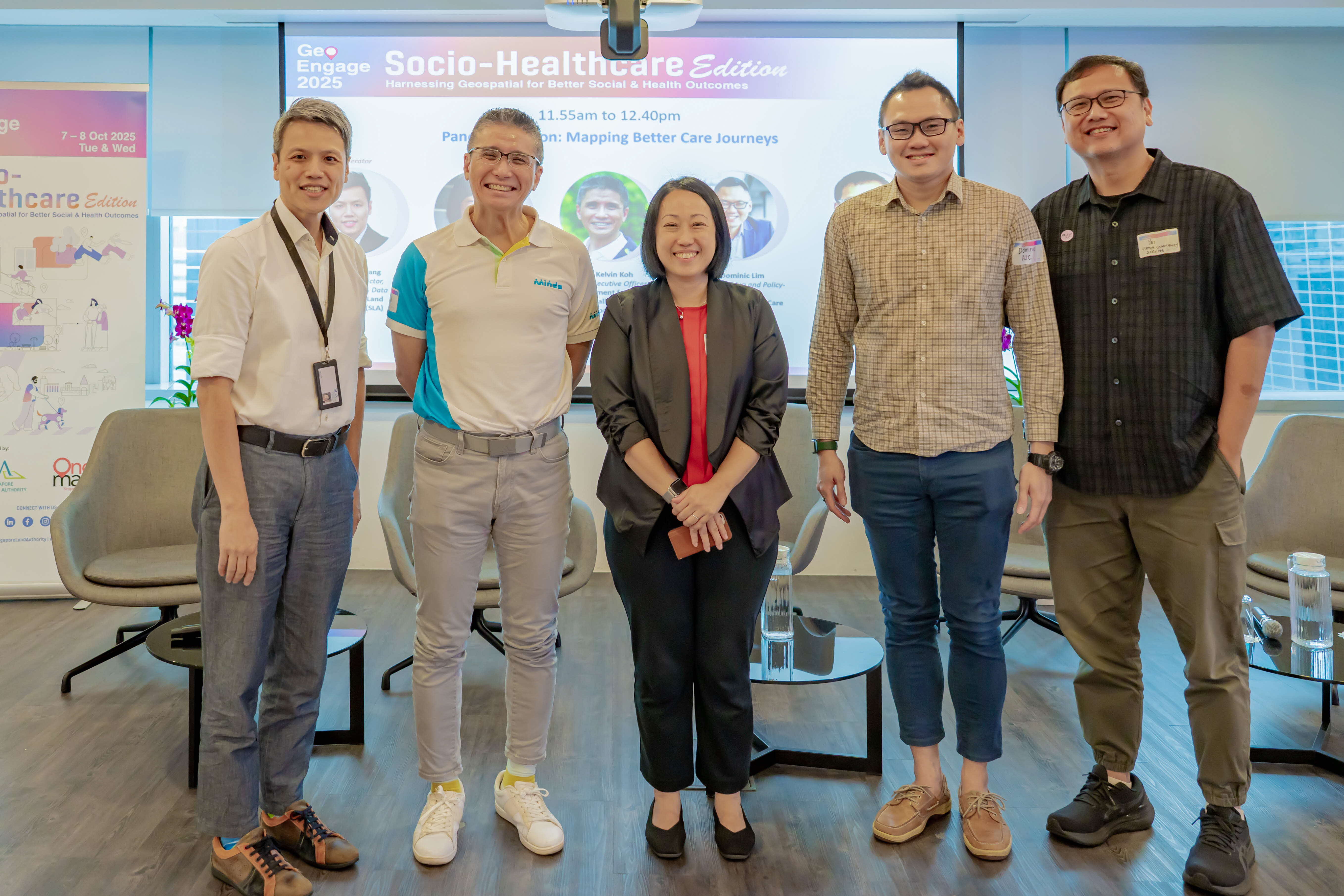
Panel Discussion on Day One: Mapping Better Care Journeys
Moderated by Mr Lim Liyang, Deputy Director (Geospatial & Data) at SLA, the panel brought together voices from across sectors – Prof. Elaine Ho (NUS), Mr Kelvin Koh (MINDS), Mr Dominic Lim (AIC), and Mr Yet Tun Hoong (VCS) – for an afternoon of lively and thought-provoking discussion.
Highlights include:
💡 Impact of Geospatial in Socio-Healthcare: Speakers shared on the most significant impact that geospatial has made in their work, such as the use of geospatial data and insights which reveal the actual needs of the older adults - they thrive well when supported by community-wide networks rather than being confined to traditional residential-based care models.
💡 Addressing Clients’ Challenges: The journey into geospatial technology began with a simple but telling observation: clients were travelling unnecessarily long distances to access services, often bypassing closer alternatives. This realisation sparked the development of mapping solutions that now help clients easily identify their nearest service centres, dramatically reducing travel burdens and making support more accessible to those who need it most.
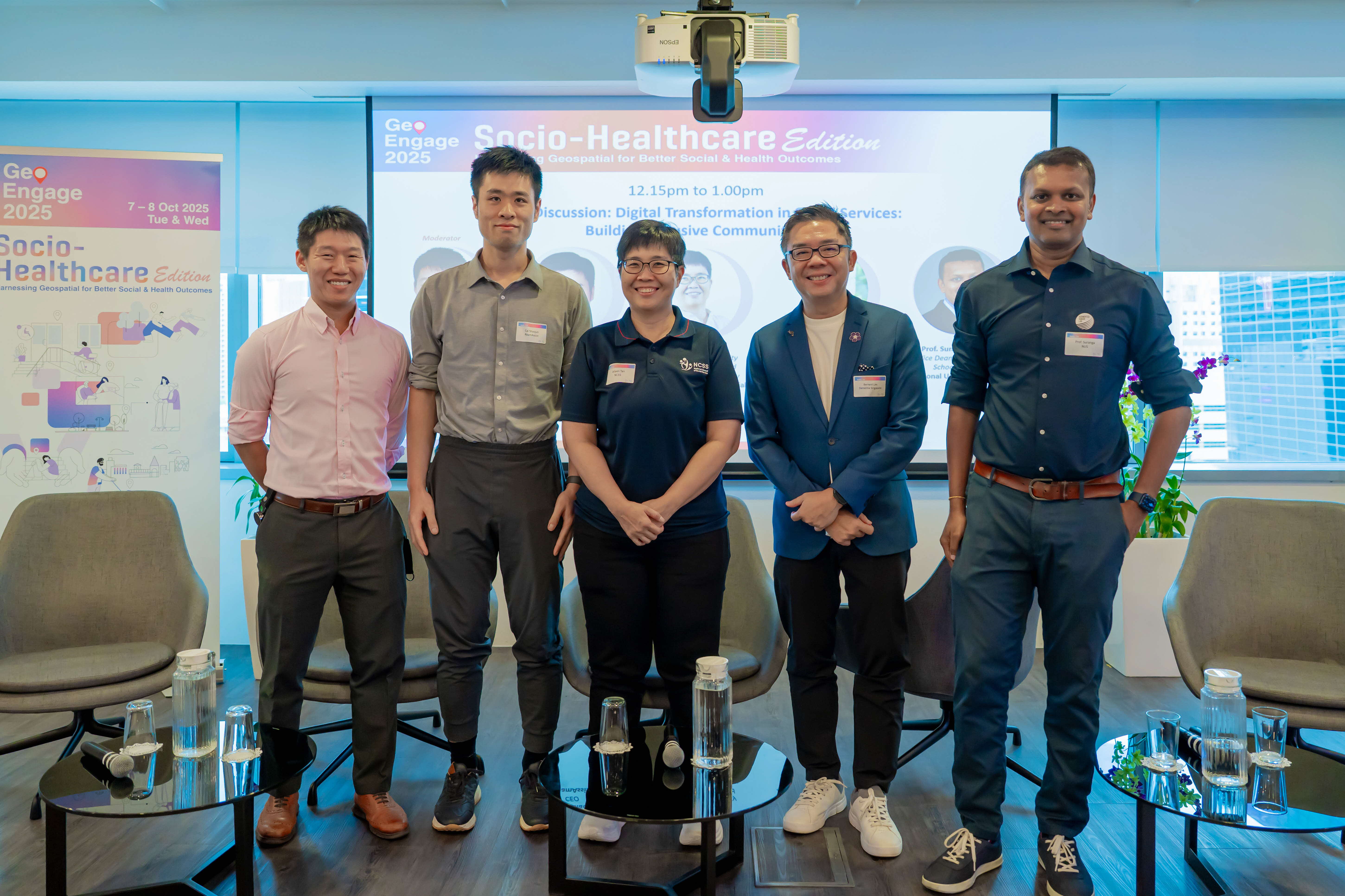
Panel Discussion on Day Two: Digital Transformation in Social Services: Building Inclusive Communities
Moderated by Mr Tan Guo Jun, Deputy Director (Geospatial & Data) at SLA, the panel brought together voices from across sectors – Mr Bernard Lim (Dementia Singapore), Prof. Suranga Nanayakkara (NUS), Ms Aileen Tan (NCSS), and Mr Cai Shaojun (RoamAssist) – for an afternoon of lively and thought-provoking discussion.
Highlights include:
💡 Putting people first: The panel explored how technology can foster inclusivity when designed around real human needs – and introduced to communities gradually through a phased approach.
💡 Empowering the social sector: Beyond tech professionals, speakers emphasised that those in the social service space can also be technologists in their own right, by picking up digital skills and weaving them into their daily work.
💡 Design for everyone: For technological adoption to be viable in the long run, solutions should be designed to benefit a wider audience – for example, a robotic guide dog need not only to assist the visually impaired, but could also serve general wayfinding and guidance needs for anyone in need.
💡 Collaboration is key: The discussion wrapped up with a call for deeper partnerships across academia, industry, and the social service sector – because building an inclusive digital ecosystem takes all of us.
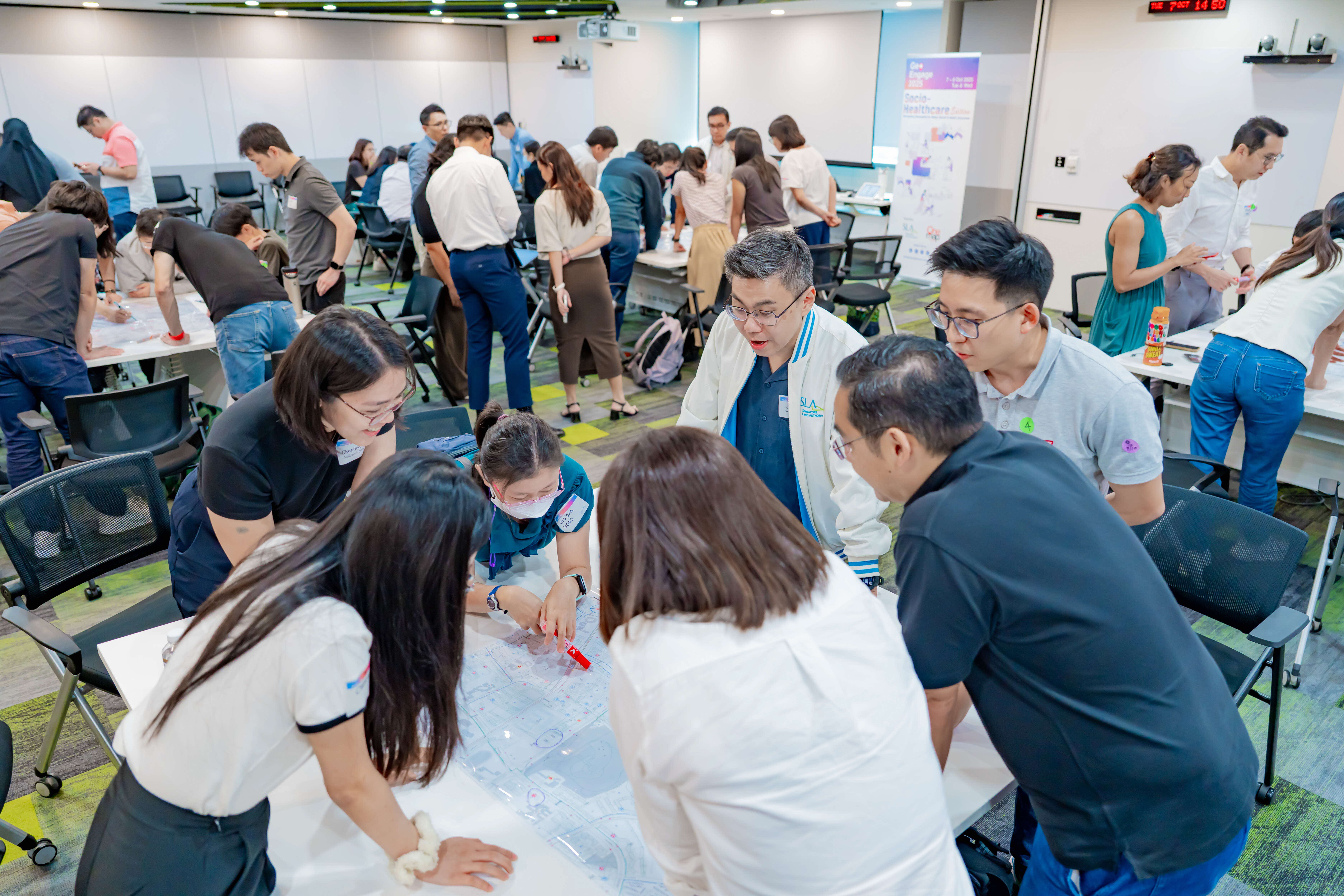
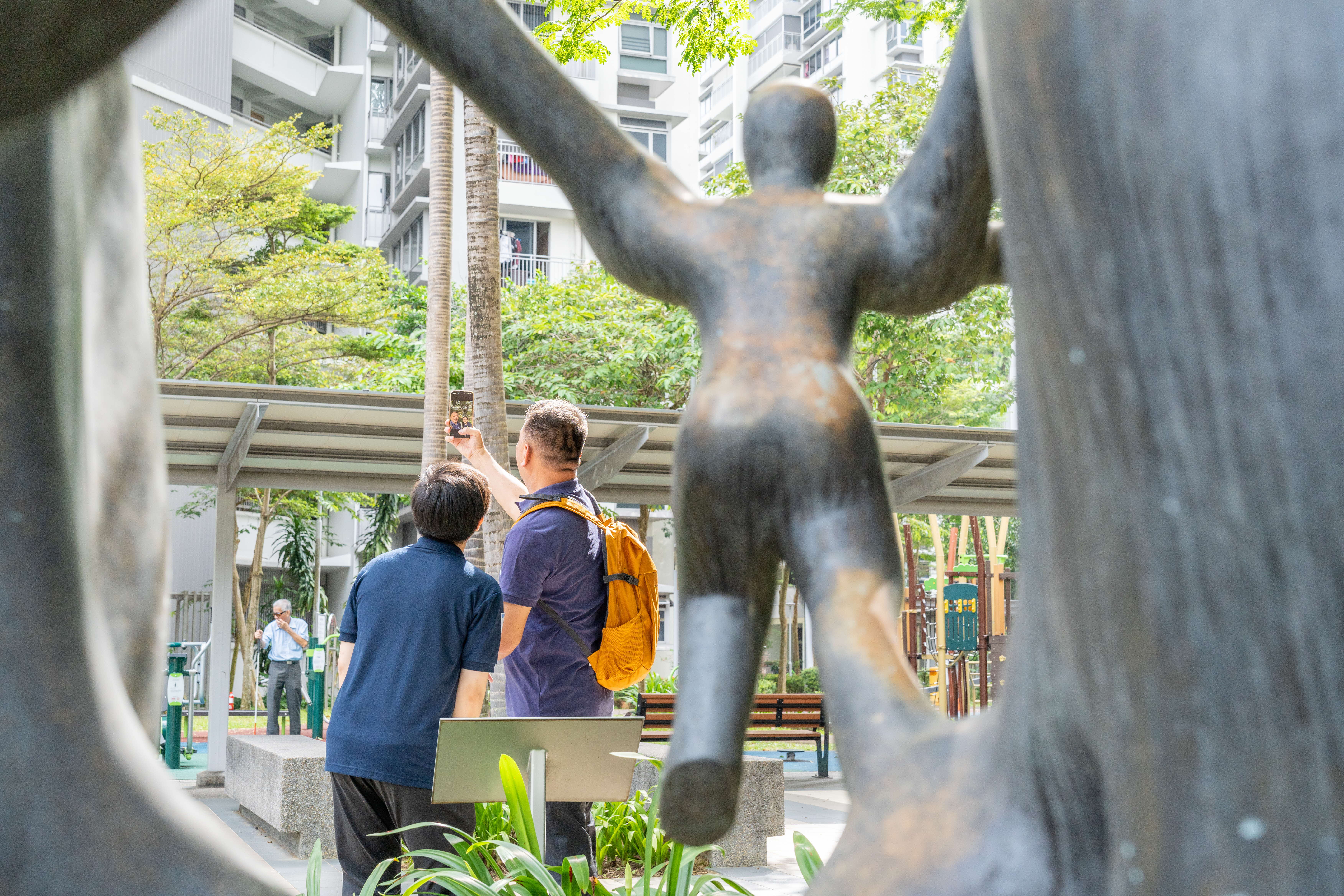
Hands-On Learning, From Classroom to Field 🎒
Participants also got to roll up their sleeves in two interactive workshops!
Day one’s Geospatialisation Workshop provided a fun introduction to location-based intelligence, with real-world use cases and group discussions that showcased how geospatial tools can drive impact in the social sector.

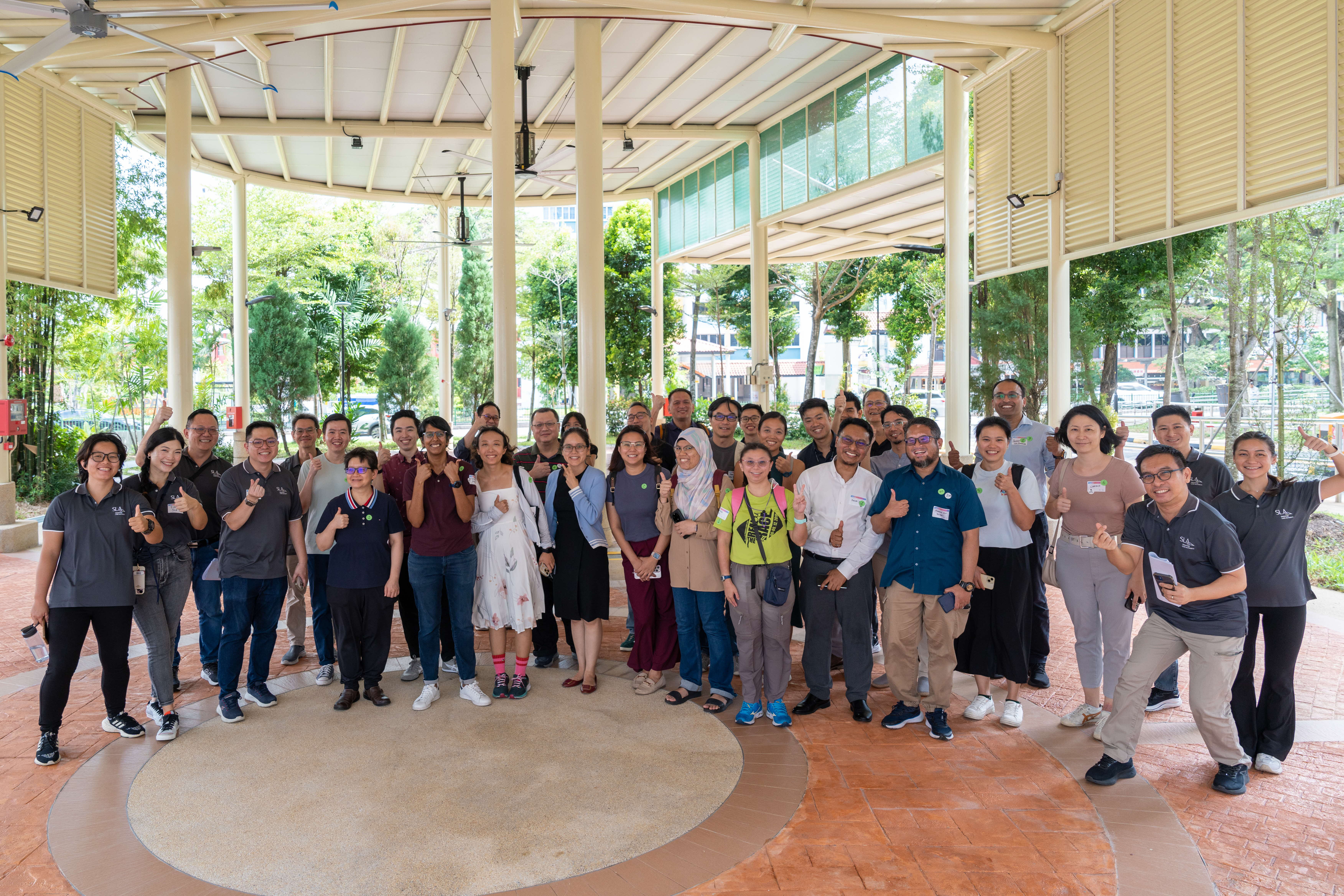
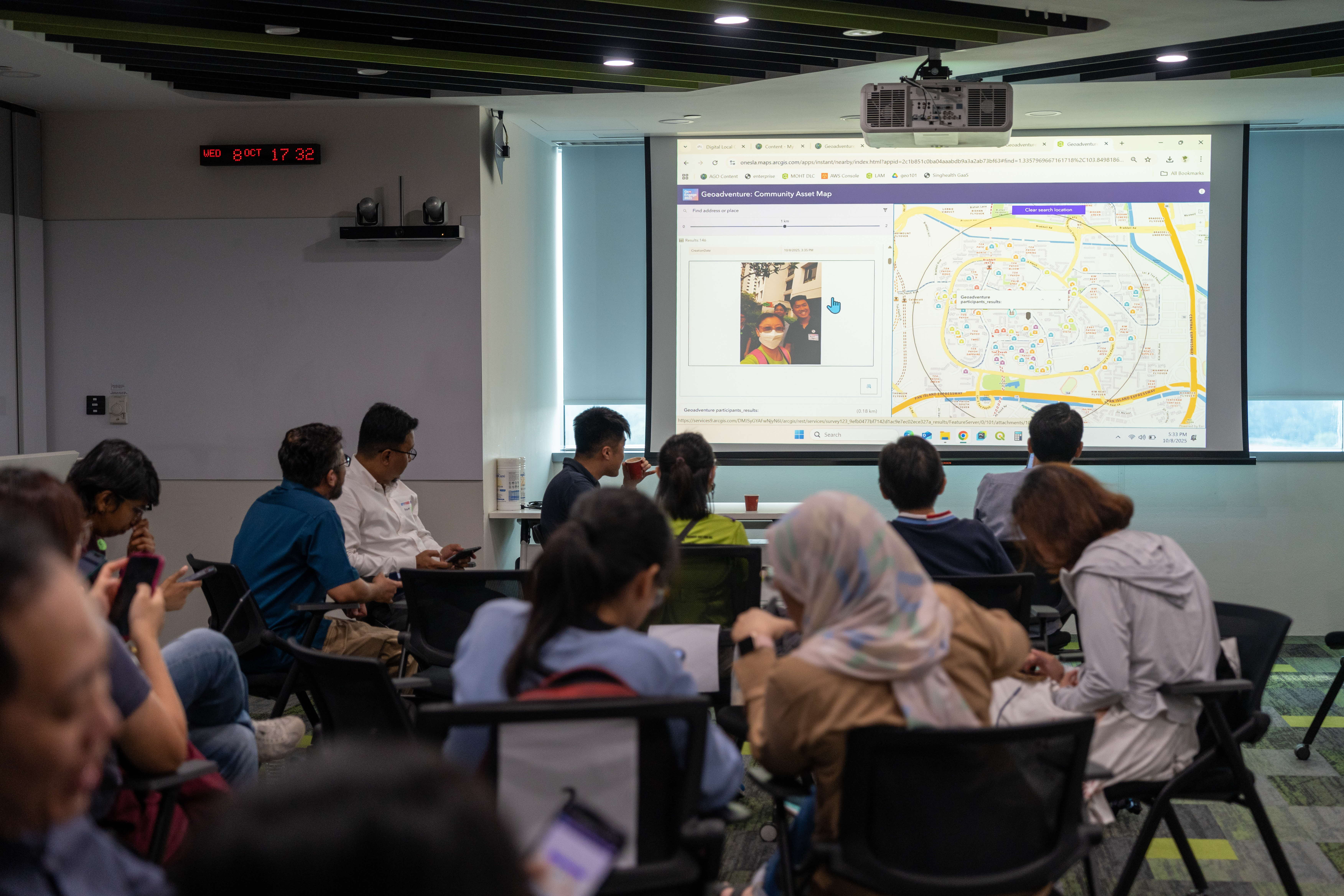
In day two’s GeoAdventure Workshop, participants got to experience how geospatial technology connects to our daily lives first-hand – with a foray outdoors! They ventured into the heartlands to ‘collect’ points of interest using the Survey123 app, and then watched their data come alive on a map back at Revenue House.
By the end of GeoEngage 2025, one thing was clear – geospatial technology is not just about data and maps. It’s about improving lives, enabling care, and mapping a better future for all.
Stay tuned for next year’s edition!